Aygut Facts
| Area | 67.8 km² |
| Population | 769 |
| Male Population | 365 (47.5%) |
| Female Population | 404 (52.5%) |
| Population change (1975 to 2020) | -27.5% |
| Population change (2000 to 2020) | -17.2% |
| Median Age | 30.4 years (Male: 28.3, Female: 32.6) |
| GDP per capita (PPP) | $10,865 (2022) |
| Local Time | |
| Timezone | Armenia Standard Time |
| Lat & Lng | 40.68298, 45.17634 |
| Postal Codes | 1306 |
Map of Aygut
Interactive Map
Aygut Population
Years 1975 to 2030
| Data | 1975 | 1990 | 2000 | 2015 | 2020 | 2025* | 2030* |
|---|---|---|---|---|---|---|---|
| Population | 1,061 | 1,174 | 929 | 782 | 769 | 767 | 759 |
| Population Density | 15.6 / km² | 17.3 / km² | 13.7 / km² | 11.5 / km² | 11.3 / km² | 11.3 / km² | 11.2 / km² |
Aygut Population change from 2000 to 2020
Decrease of 17.2% from year 2000 to 2020
| Location | Change since 1975 | Change since 1990 | Change since 2000 |
|---|---|---|---|
| Aygut | -27.5% | -34.5% | -17.2% |
| Gegharkunik Province | — | — | — |
| Armenia | — | — | — |
Aygut Median Age
Median Age: 30.4 years
| Location | Median Age | Median Age (Female) | Median Age (Male) |
|---|---|---|---|
| Aygut | 30.4 yrs | 32.6 yrs | 28.3 yrs |
| Gegharkunik Province | 30.3 yrs | 32.5 yrs | 28.2 yrs |
| Armenia | 33.1 yrs | 35.3 yrs | 30.8 yrs |
Aygut Population Density
Population Density: 11.3 / km²
| Location | Population | Area | Density |
|---|---|---|---|
| Aygut | 769 | 67.8 km² | 11.3 / km² |
| Gegharkunik Province | 225,308 | 5,271.9 km² | 42.7 / km² |
| Armenia | 3 million | 29,714.7 km² | 102 / km² |
Aygut Historical and Projected Population
Estimated Population from 0 to 2100
- JRC (European Commission's Joint Research Centre) work on the GHS built-up grid
- CIESIN (Center for International Earth Science Information Network)
- [Link] Klein Goldewijk, K., Beusen, A., Doelman, J., and Stehfest, E.: Anthropogenic land use estimates for the Holocene – HYDE 3.2, Earth Syst. Sci. Data, 9, 927–953, https://doi.org/10.5194/essd-9-927-2017, 2017.
Human Development Index (HDI)
Statistic composite index of life expectancy, education, and per capita income.
Aygut Gross Domestic Product (GDP)
GDP per capita, PPP (constant 2017 international $)
| Data | 1990 | 1995 | 2000 | 2005 | 2010 | 2015 | 2020 | 2022 |
|---|---|---|---|---|---|---|---|---|
| GDP per capita | $3,501 | $1,972 | $2,454 | $4,504 | $5,500 | $6,939 | $9,064 | $10,865 |
| Total GDP | $4.9M | $2.5M | $2.8M | $4.8M | $5.5M | $6.6M | $8.8M | $10.6M |
Aygut CO2 Emissions
Carbon Dioxide (CO2) Emissions Per Capita in Tonnes Per Year
| Location | CO2 Emissions | CO2 Emissions Per Capita | CO2 Emissions Intensity |
|---|---|---|---|
| Aygut | 1,565 tn | 2.03 tn | 23.1 tons/km² |
| Gegharkunik Province | 461,660 tn | 2.05 tn | 87.6 tons/km² |
| Armenia | 6,386,017 tn | 2.12 tn | 214.9 tons/km² |
| 2013 CO2 emissions (tonnes/year) | 1,565 tn |
| 2013 CO2 emissions (tonnes/year) per capita | 2.03 tn |
| 2013 CO2 emissions intensity (tonnes/km²/year) | 23.1 tons/km² |
Natural Hazards Risk
Relative risk out of 10
| Hazard | Risk Level |
|---|---|
| Drought | Low (2) |
| Earthquake | High (7.9) |
| Landslide | High (8) |
* Risk, particularly concerning flood or landslide, may not be for the entire area.
- Dilley, M., R.S. Chen, U. Deichmann, A.L. Lerner-Lam, M. Arnold, J. Agwe, P. Buys, O. Kjekstad, B. Lyon, and G. Yetman. 2005. Natural Disaster Hotspots: A Global Risk Analysis. Washington, D.C.: World Bank. https://doi.org/10.1596/0-8213-5930-4.
- Center for Hazards and Risk Research - CHRR - Columbia University, Center for International Earth Science Information Network - CIESIN - Columbia University, and Norwegian Geotechnical Institute - NGI. 2005. Global Landslide Hazard Distribution. Palisades, NY: NASA Socioeconomic Data and Applications Center (SEDAC). https://doi.org/10.7927/H4P848VZ.
- Center for Hazards and Risk Research - CHRR - Columbia University, Center for International Earth Science Information Network - CIESIN - Columbia University, and International Research Institute for Climate and Society - IRI - Columbia University. 2005. Global Drought Hazard Frequency and Distribution. Palisades, NY: NASA Socioeconomic Data and Applications Center (SEDAC). https://doi.org/10.7927/H4VX0DFT.
- Center for Hazards and Risk Research - CHRR - Columbia University, Center for International Earth Science Information Network - CIESIN - Columbia University. 2005. Global Earthquake Hazard Distribution - Peak Ground Acceleration. Palisades, NY: NASA Socioeconomic Data and Applications Center (SEDAC). https://doi.org/10.7927/H4BZ63ZS.
Recent Nearby Earthquakes
Magnitude 3.0 and greater
| Date▼ | Time↕ | Magnitude↕ | Distance↕ | Depth↕ | Location↕ | Link |
|---|---|---|---|---|---|---|
| 6/6/18 | 1:07 PM | 4.2 | 77.8 km | 10,000 m | 2km NE of Arevashogh, Armenia | usgs.gov |
| 4/6/15 | 1:26 AM | 4.1 | 50.1 km | 10,000 m | 5km SW of Lanjaghbyur, Armenia | usgs.gov |
| 10/3/14 | 9:45 AM | 4 | 49.3 km | 34,270 m | 7km WNW of Tovuz, Azerbaijan | usgs.gov |
| 11/4/08 | 6:53 PM | 3.3 | 99.4 km | 5,000 m | Armenia | usgs.gov |
| 4/29/08 | 5:20 AM | 3.7 | 76.2 km | 10,000 m | Armenia | usgs.gov |
| 7/9/07 | 9:33 AM | 4.4 | 97.5 km | 15,000 m | Armenia | usgs.gov |
| 4/11/07 | 7:43 PM | 3.5 | 84.9 km | 5,000 m | Armenia | usgs.gov |
| 1/12/07 | 8:00 AM | 4.2 | 62.5 km | 5,000 m | Armenia | usgs.gov |
| 1/21/06 | 1:17 PM | 3.7 | 99.3 km | 37,900 m | Georgia (Sak'art'velo) | usgs.gov |
| 3/13/05 | 3:02 AM | 4.6 | 68.3 km | 10,000 m | Azerbaijan | usgs.gov |
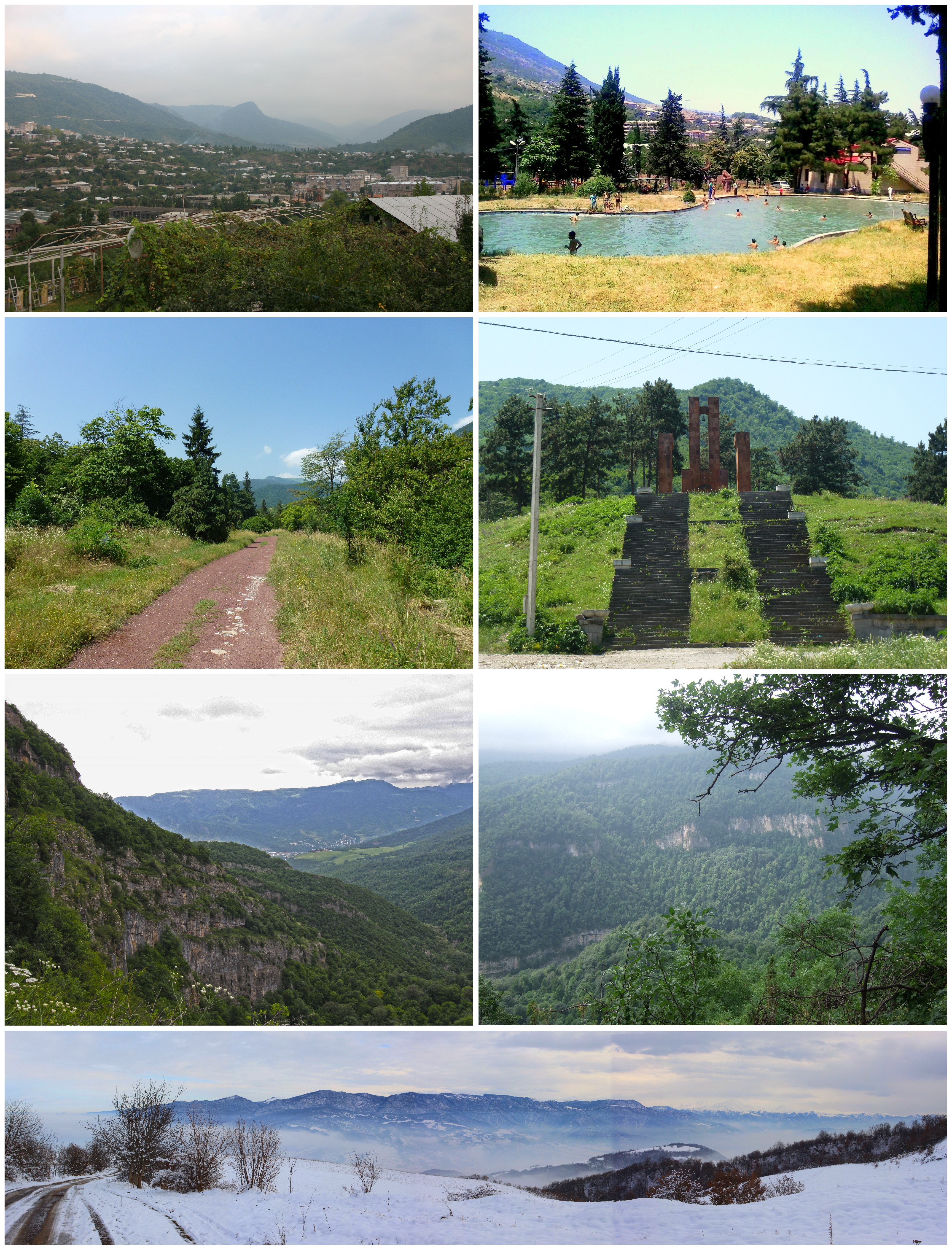
Aygut
Aygut (Armenian: Այգուտ; formerly known as Gyolkend in Turkish, named after the seven nearby lakes) is a village located to the north of Lake Sevan in the Gegharkunik Province of Armenia. The nearby village of Chapkut also belongs to the community of..
Aygut Wikipedia Page

About Our Data
The data on this page is estimated using a number of publicly available tools and resources. It is provided without warranty, and could contain inaccuracies. Use at your own risk.