Industries
Business Distribution by Industry in Jermuk
| Industry Description | Number of Establishments |
|---|---|
| Other accommodation | 20 |
| Hotels and motels | 13 |
| Restaurants | 12 |
Jermuk Facts
| Area | 144.4 km² |
| Population | 5,022 |
| Male Population | 2,357 (46.9%) |
| Female Population | 2,665 (53.1%) |
| Population change (1975 to 2020) | -28.6% |
| Population change (2000 to 2020) | -19.1% |
| Median Age | 34 years (Male: 31.1, Female: 36.6) |
| Area Codes | 287 |
| Neighborhoods | Kechut |
| Local Time | |
| Timezone | Armenia Standard Time |
| Lat & Lng | 39.84168, 45.66949 |
| Postal Codes | 3701, 3702, 3703, 3704 |
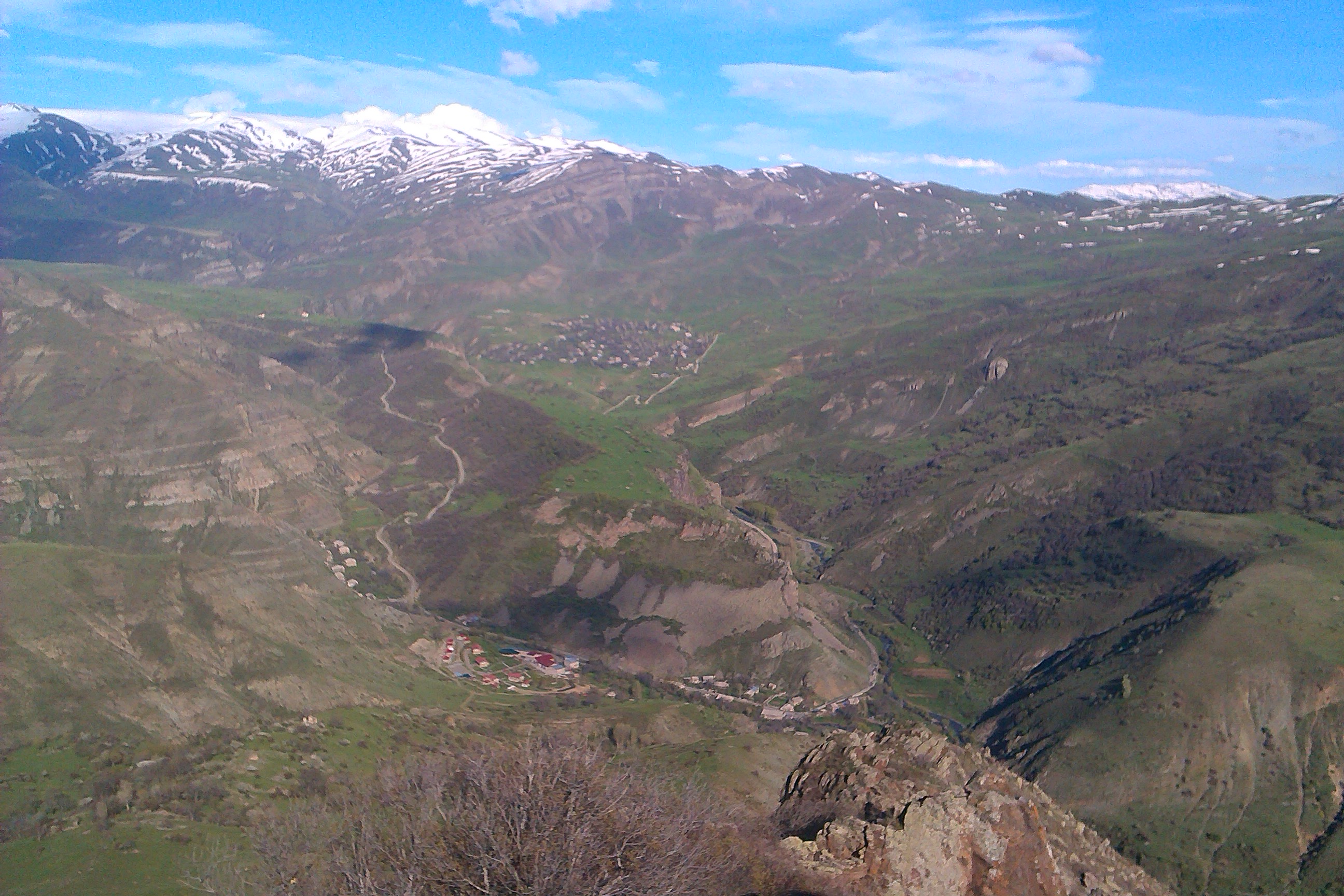
Map of Jermuk
Interactive Map
Jermuk Population
Years 1975 to 2020
| Data | 1975 | 1990 | 2000 | 2015 | 2020 |
|---|---|---|---|---|---|
| Population | 7,029 | 7,799 | 6,211 | 5,245 | 5,022 |
| Population Density | 48.7 / km² | 54 / km² | 43 / km² | 36.3 / km² | 34.8 / km² |
Jermuk Population change from 2000 to 2015
Decrease of 15.6% from year 2000 to 2015
| Location | Change since 1975 | Change since 1990 | Change since 2000 |
|---|---|---|---|
| Jermuk | -25.4% | -32.7% | -15.6% |
| Vayots Dzor Province | -14.4% | -26.4% | -10.5% |
| Armenia | +6.8% | -14.9% | -1.9% |
Jermuk Median Age
Median Age: 34 years
| Location | Median Age | Median Age (Female) | Median Age (Male) |
|---|---|---|---|
| Jermuk | 34 yrs | 36.6 yrs | 31.1 yrs |
| Vayots Dzor Province | 31.7 yrs | 33.9 yrs | 29.4 yrs |
| Armenia | 33.1 yrs | 35.3 yrs | 30.8 yrs |
Jermuk Population Density
Population Density: 34.8 / km²
| Location | Population | Area | Density |
|---|---|---|---|
| Jermuk | 5,022 | 144.4 km² | 34.8 / km² |
| Vayots Dzor Province | 50,019 | 2,380.8 km² | 21 / km² |
| Armenia | 3 million | 29,714.7 km² | 102 / km² |
Jermuk Historical and Projected Population
Estimated Population from 0 to 2100
- JRC (European Commission's Joint Research Centre) work on the GHS built-up grid
- CIESIN (Center for International Earth Science Information Network)
- [Link] Klein Goldewijk, K., Beusen, A., Doelman, J., and Stehfest, E.: Anthropogenic land use estimates for the Holocene – HYDE 3.2, Earth Syst. Sci. Data, 9, 927–953, https://doi.org/10.5194/essd-9-927-2017, 2017.
Area Codes
Percentage Area Codes used by businesses in Jermuk
Postal Codes
Percentage of businesses by Postal Codes in Jermuk
Price Distribution
Business distribution by price for Jermuk
Human Development Index (HDI)
Statistic composite index of life expectancy, education, and per capita income.
Jermuk CO2 Emissions
Carbon Dioxide (CO2) Emissions Per Capita in Tonnes Per Year
| Location | CO2 Emissions | CO2 Emissions Per Capita | CO2 Emissions Intensity |
|---|---|---|---|
| Jermuk | 9,832 tn | 1.96 tn | 68.1 tons/km² |
| Vayots Dzor Province | 102,298 tn | 2.05 tn | 43 tons/km² |
| Armenia | 6,386,017 tn | 2.12 tn | 214.9 tons/km² |
| 2013 CO2 emissions (tonnes/year) | 9,832 tn |
| 2013 CO2 emissions (tonnes/year) per capita | 1.96 tn |
| 2013 CO2 emissions intensity (tonnes/km²/year) | 68.1 tons/km² |
Natural Hazards Risk
Relative risk out of 10
| Hazard | Risk Level |
|---|---|
| Drought | High (8) |
| Earthquake | High (8) |
| Landslide | High (8) |
* Risk, particularly concerning flood or landslide, may not be for the entire area.
- Dilley, M., R.S. Chen, U. Deichmann, A.L. Lerner-Lam, M. Arnold, J. Agwe, P. Buys, O. Kjekstad, B. Lyon, and G. Yetman. 2005. Natural Disaster Hotspots: A Global Risk Analysis. Washington, D.C.: World Bank. https://doi.org/10.1596/0-8213-5930-4.
- Center for Hazards and Risk Research - CHRR - Columbia University, Center for International Earth Science Information Network - CIESIN - Columbia University, and Norwegian Geotechnical Institute - NGI. 2005. Global Landslide Hazard Distribution. Palisades, NY: NASA Socioeconomic Data and Applications Center (SEDAC). https://doi.org/10.7927/H4P848VZ.
- Center for Hazards and Risk Research - CHRR - Columbia University, Center for International Earth Science Information Network - CIESIN - Columbia University, and International Research Institute for Climate and Society - IRI - Columbia University. 2005. Global Drought Hazard Frequency and Distribution. Palisades, NY: NASA Socioeconomic Data and Applications Center (SEDAC). https://doi.org/10.7927/H4VX0DFT.
- Center for Hazards and Risk Research - CHRR - Columbia University, Center for International Earth Science Information Network - CIESIN - Columbia University. 2005. Global Earthquake Hazard Distribution - Peak Ground Acceleration. Palisades, NY: NASA Socioeconomic Data and Applications Center (SEDAC). https://doi.org/10.7927/H4BZ63ZS.
Recent Nearby Earthquakes
Magnitude 3.0 and greater
| Date▼ | Time↕ | Magnitude↕ | Distance↕ | Depth↕ | Location↕ | Link |
|---|---|---|---|---|---|---|
| 2/28/17 | 6:17 AM | 3.6 | 97.7 km | 10,000 m | 5km NW of Agarak, Armenia | usgs.gov |
| 4/6/15 | 1:26 AM | 4.1 | 65.7 km | 10,000 m | 5km SW of Lanjaghbyur, Armenia | usgs.gov |
| 1/7/15 | 11:00 PM | 4.1 | 66.7 km | 10,000 m | 18km SSE of Hats'avan, Armenia | usgs.gov |
| 4/29/08 | 5:20 AM | 3.7 | 39.4 km | 10,000 m | Armenia | usgs.gov |
| 1/12/07 | 8:00 AM | 4.2 | 91.8 km | 5,000 m | Armenia | usgs.gov |
| 9/1/05 | 6:17 PM | 4.2 | 92.9 km | 15,000 m | Turkey-Iran border region | usgs.gov |
| 3/13/05 | 3:02 AM | 4.6 | 57.2 km | 10,000 m | Azerbaijan | usgs.gov |
| 6/17/01 | 11:22 AM | 4.2 | 67.6 km | 33,000 m | Naxcivan, Azerbaijan | usgs.gov |
| 1/23/01 | 9:27 AM | 4.2 | 88.7 km | 33,000 m | Azerbaijan | usgs.gov |
| 10/28/00 | 8:00 PM | 3.4 | 62.3 km | 33,000 m | Azerbaijan | usgs.gov |
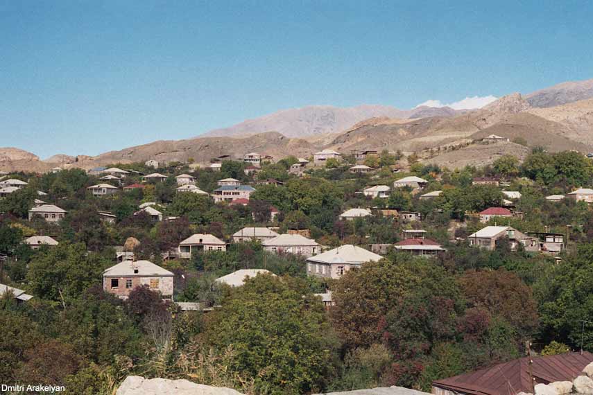
Jermuk
Jermuk (Armenian: Ջերմուկ) is a mountain spa town in the southern Armenian province of Vayots Dzor Province, 53 km east of the provincial capital Yeghegnadzor. It was a popular destination during the Soviet era and nowadays is still famous for its ho..
Jermuk Wikipedia Page

About Our Data
The data on this page is estimated using a number of publicly available tools and resources. It is provided without warranty, and could contain inaccuracies. Use at your own risk.