Categories in Meghri
Meghri Facts
| Area | 38.7 km² |
| Population | 4,144 |
| Male Population | 2,053 (49.5%) |
| Female Population | 2,091 (50.5%) |
| Population change (1975 to 2020) | -12.2% |
| Population change (2000 to 2020) | -13.2% |
| Median Age | 33.9 years (Male: 31.9, Female: 36) |
| Area Codes | 286, 2860 |
| Neighborhoods | Mets Tagh, Pokr Tagh |
| Local Time | |
| Timezone | Armenia Standard Time |
| Lat & Lng | 38.90292, 46.24458 |
| Postal Codes | 3402, 3404 |
Map of Meghri
Interactive Map
Meghri Population
Years 1975 to 2020
| Data | 1975 | 1990 | 2000 | 2015 | 2020 |
|---|---|---|---|---|---|
| Population | 4,722 | 5,712 | 4,776 | 4,391 | 4,144 |
| Population Density | 122.1 / km² | 147.6 / km² | 123.5 / km² | 113.5 / km² | 107.1 / km² |
Meghri Population change from 2000 to 2015
Decrease of 8.1% from year 2000 to 2015
| Location | Change since 1975 | Change since 1990 | Change since 2000 |
|---|---|---|---|
| Meghri | -7% | -23.1% | -8.1% |
| Syunik Province | -25.8% | -31.3% | -14.6% |
| Armenia | +6.8% | -14.9% | -1.9% |
Meghri Median Age
Median Age: 33.9 years
| Location | Median Age | Median Age (Female) | Median Age (Male) |
|---|---|---|---|
| Meghri | 33.9 yrs | 36 yrs | 31.9 yrs |
| Syunik Province | 33.3 yrs | 35.2 yrs | 31.4 yrs |
| Armenia | 33.1 yrs | 35.3 yrs | 30.8 yrs |
Meghri Population Density
Population Density: 107 / km²
| Location | Population | Area | Density |
|---|---|---|---|
| Meghri | 4,144 | 38.7 km² | 107 / km² |
| Syunik Province | 99,374 | 4,404.1 km² | 22.6 / km² |
| Armenia | 3 million | 29,714.7 km² | 102 / km² |
Meghri Historical and Projected Population
Estimated Population from 0 to 2100
- JRC (European Commission's Joint Research Centre) work on the GHS built-up grid
- CIESIN (Center for International Earth Science Information Network)
- [Link] Klein Goldewijk, K., Beusen, A., Doelman, J., and Stehfest, E.: Anthropogenic land use estimates for the Holocene – HYDE 3.2, Earth Syst. Sci. Data, 9, 927–953, https://doi.org/10.5194/essd-9-927-2017, 2017.
Area Codes
Percentage Area Codes used by businesses in Meghri
Human Development Index (HDI)
Statistic composite index of life expectancy, education, and per capita income.
Meghri CO2 Emissions
Carbon Dioxide (CO2) Emissions Per Capita in Tonnes Per Year
| Location | CO2 Emissions | CO2 Emissions Per Capita | CO2 Emissions Intensity |
|---|---|---|---|
| Meghri | 10,400 tn | 2.51 tn | 268.8 tons/km² |
| Syunik Province | 238,978 tn | 2.4 tn | 54.3 tons/km² |
| Armenia | 6,386,017 tn | 2.12 tn | 214.9 tons/km² |
| 2013 CO2 emissions (tonnes/year) | 10,400 tn |
| 2013 CO2 emissions (tonnes/year) per capita | 2.51 tn |
| 2013 CO2 emissions intensity (tonnes/km²/year) | 268.8 tons/km² |
Natural Hazards Risk
Relative risk out of 10
| Hazard | Risk Level |
|---|---|
| Drought | High (8) |
| Earthquake | Medium (6.4) |
| Landslide | Medium (6) |
* Risk, particularly concerning flood or landslide, may not be for the entire area.
- Dilley, M., R.S. Chen, U. Deichmann, A.L. Lerner-Lam, M. Arnold, J. Agwe, P. Buys, O. Kjekstad, B. Lyon, and G. Yetman. 2005. Natural Disaster Hotspots: A Global Risk Analysis. Washington, D.C.: World Bank. https://doi.org/10.1596/0-8213-5930-4.
- Center for Hazards and Risk Research - CHRR - Columbia University, Center for International Earth Science Information Network - CIESIN - Columbia University, and Norwegian Geotechnical Institute - NGI. 2005. Global Landslide Hazard Distribution. Palisades, NY: NASA Socioeconomic Data and Applications Center (SEDAC). https://doi.org/10.7927/H4P848VZ.
- Center for Hazards and Risk Research - CHRR - Columbia University, Center for International Earth Science Information Network - CIESIN - Columbia University, and International Research Institute for Climate and Society - IRI - Columbia University. 2005. Global Drought Hazard Frequency and Distribution. Palisades, NY: NASA Socioeconomic Data and Applications Center (SEDAC). https://doi.org/10.7927/H4VX0DFT.
- Center for Hazards and Risk Research - CHRR - Columbia University, Center for International Earth Science Information Network - CIESIN - Columbia University. 2005. Global Earthquake Hazard Distribution - Peak Ground Acceleration. Palisades, NY: NASA Socioeconomic Data and Applications Center (SEDAC). https://doi.org/10.7927/H4BZ63ZS.
Recent Nearby Earthquakes
Magnitude 3.0 and greater
| Date▼ | Time↕ | Magnitude↕ | Distance↕ | Depth↕ | Location↕ | Link |
|---|---|---|---|---|---|---|
| 4/16/18 | 12:02 AM | 3.5 | 89.1 km | 10,000 m | 33km W of Marand, Iran | usgs.gov |
| 2/28/17 | 6:17 AM | 3.6 | 43.5 km | 10,000 m | 5km NW of Agarak, Armenia | usgs.gov |
| 8/2/16 | 10:15 AM | 3.8 | 67 km | 7,700 m | 29km W of Ahar, Iran | usgs.gov |
| 1/7/15 | 11:00 PM | 4.1 | 48.8 km | 10,000 m | 18km SSE of Hats'avan, Armenia | usgs.gov |
| 3/9/14 | 6:34 AM | 3.5 | 91.2 km | 16,700 m | 8km E of Tabriz, Iran | usgs.gov |
| 12/19/13 | 7:58 AM | 4 | 85.5 km | 9,770 m | 28km SW of Ahar, Iran | usgs.gov |
| 6/28/13 | 5:13 AM | 4.2 | 90.1 km | 14,800 m | 28km WSW of Marand, Iran | usgs.gov |
| 4/18/13 | 10:39 AM | 4.8 | 89.4 km | 10,300 m | 27km W of Marand, Iran | usgs.gov |
| 3/8/13 | 1:45 PM | 4 | 70.3 km | 4,000 m | northwestern Iran | usgs.gov |
| 3/3/13 | 8:59 PM | 4.2 | 67.5 km | 6,000 m | northwestern Iran | usgs.gov |
Meghri
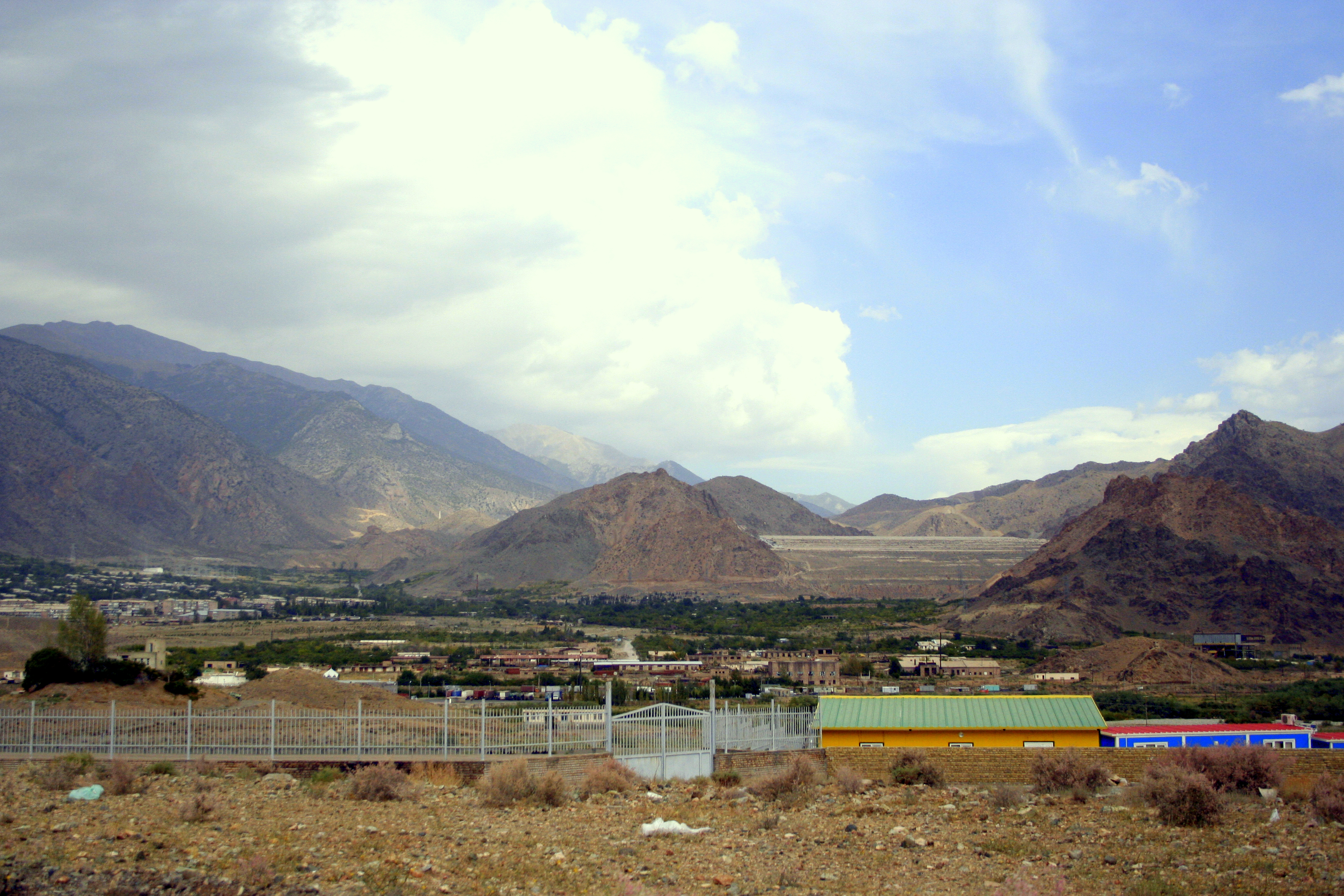
Meghri (Armenian: Մեղրի) is a town in southern Armenia, located in the Syunik Province, near the border with Iran. The town's economy is based on the food industry, and contains a bread-baking factory, canneries and a winery. Meghri is the only locat..
Meghri Wikipedia Page

About Our Data
The data on this page is estimated using a number of publicly available tools and resources. It is provided without warranty, and could contain inaccuracies. Use at your own risk.