Categories in Bihać
Industries
Business Distribution by Industry in Bihać
| Industry Description | Number of Establishments | Average Google Rating |
|---|---|---|
| Shopping | 92 | 4.2 |
| Restaurants | 25 | 4.3 |
| Bars, pubs and taverns | 23 | 4.5 |
| Cafes | 19 | 4.4 |
| Other accommodation | 18 | 4.4 |
| Education | 18 | 4.5 |
| Sports and recreation | 17 | 4.2 |
| All food and beverage | 14 | 4.2 |
| Banks | 14 | 4.1 |
| Electronics stores | 14 | 4.6 |
| Religion | 13 | 4.8 |
| Pharmacies and drug stores | 12 | 4.4 |
| Grocery stores and supermarkets | 11 | 4.1 |
| Hotels and motels | 11 | 4.4 |
| Loan companies | 11 | 3.9 |
| Mosques | 11 | 4.8 |
| Higher education (colleges and universities) | 10 | 4.3 |
| Clothing stores | 10 | 4.4 |
| Atm's | 10 | 3.7 |
| Pizza | 9 | 4.6 |
| Department stores | 8 | 4.2 |
| Gas station | 8 | 4.3 |
| Hardware store | 7 | 4.4 |
| Secondary education | 7 | 4.4 |
| Fast food restaurants | 7 | 4.3 |
Bihać Facts
| Area | 1208.3 km² |
| Population | 60,640 |
| Male Population | 29,204 (48.2%) |
| Female Population | 31,436 (51.8%) |
| Population change (1975 to 2020) | +16.5% |
| Population change (2000 to 2020) | +6.2% |
| Median Age | 39.4 years (Male: 37.7, Female: 40.9) |
| Area Codes | 37 |
| Neighborhoods | Orljani, Mali Lug, Otoka, Ceravci, Sokolac |
| Local Time | |
| Timezone | Central European Summer Time |
| Lat & Lng | 44.81694, 15.87083 |
| Postal Codes | 77000, 77101, 77103, 77104, 77105, More |
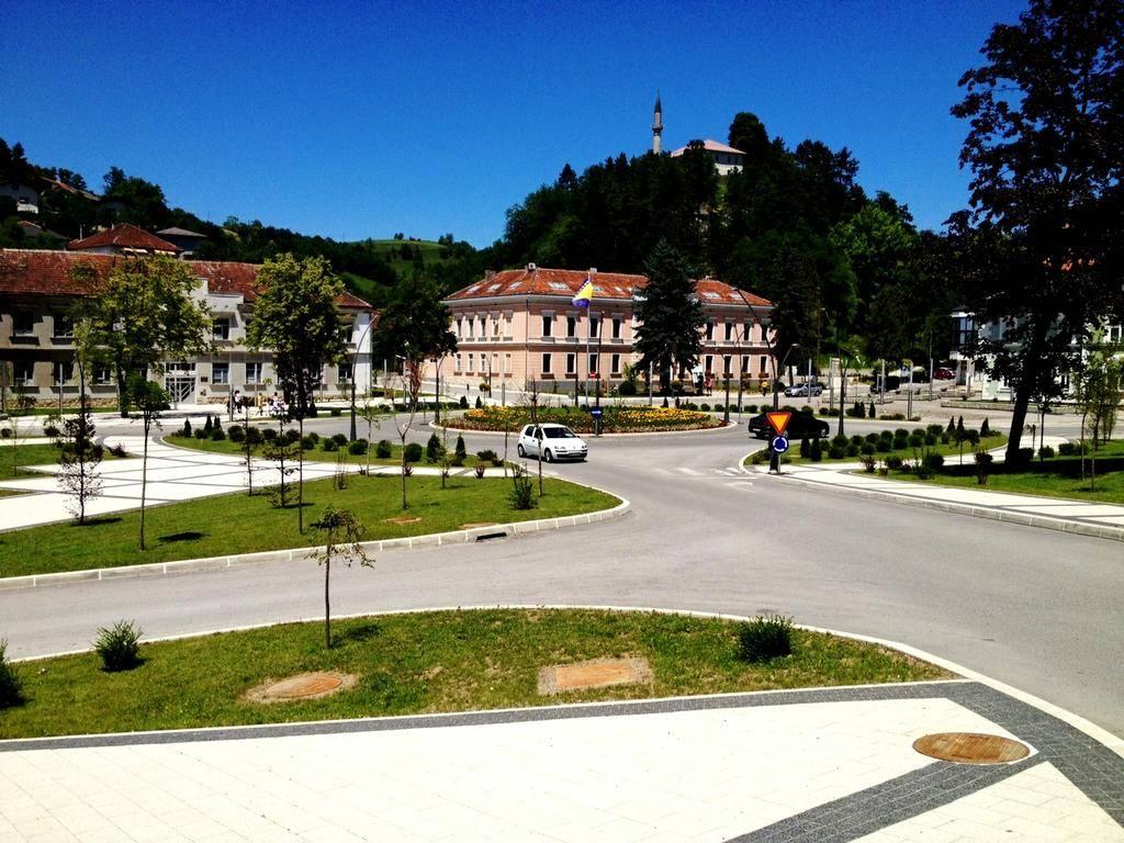
Map of Bihać
Interactive Map
Bihać Population
Years 1975 to 2020
| Data | 1975 | 1990 | 2000 | 2015 | 2020 |
|---|---|---|---|---|---|
| Population | 52,059 | 64,911 | 57,095 | 60,838 | 60,640 |
| Population Density | 43.1 / km² | 53.7 / km² | 47.3 / km² | 50.3 / km² | 50.2 / km² |
Bihać Population change from 2000 to 2015
Increase of 6.6% from year 2000 to 2015
| Location | Change since 1975 | Change since 1990 | Change since 2000 |
|---|---|---|---|
| Bihać | +16.9% | -6.3% | +6.6% |
| Bosnia and Herzegovina | -3.9% | -15.7% | +0.5% |
Bihać Median Age
Median Age: 39.4 years
| Location | Median Age | Median Age (Female) | Median Age (Male) |
|---|---|---|---|
| Bihać | 39.4 yrs | 40.9 yrs | 37.7 yrs |
| Bosnia and Herzegovina | 40 yrs | 41.5 yrs | 38.5 yrs |
Bihać Population Density
Population Density: 50.2 / km²
| Location | Population | Area | Density |
|---|---|---|---|
| Bihać | 60,640 | 1,208.3 km² | 50.2 / km² |
| Bosnia and Herzegovina | 3.8 million | 51,145.7 km² | 74.1 / km² |
Bihać Historical and Projected Population
Estimated Population from 0 to 2100
- JRC (European Commission's Joint Research Centre) work on the GHS built-up grid
- CIESIN (Center for International Earth Science Information Network)
- [Link] Klein Goldewijk, K., Beusen, A., Doelman, J., and Stehfest, E.: Anthropogenic land use estimates for the Holocene – HYDE 3.2, Earth Syst. Sci. Data, 9, 927–953, https://doi.org/10.5194/essd-9-927-2017, 2017.
Area Codes
Percentage Area Codes used by businesses in Bihać
Price Distribution
Business distribution by price for Bihać
Human Development Index (HDI)
Statistic composite index of life expectancy, education, and per capita income.
Bihać CO2 Emissions
Carbon Dioxide (CO2) Emissions Per Capita in Tonnes Per Year
| Location | CO2 Emissions | CO2 Emissions Per Capita | CO2 Emissions Intensity |
|---|---|---|---|
| Bihać | 316,865 tn | 5.23 tn | 262.2 tons/km² |
| Bosnia and Herzegovina | 19,851,042 tn | 5.24 tn | 388.1 tons/km² |
| 2013 CO2 emissions (tonnes/year) | 316,865 tn |
| 2013 CO2 emissions (tonnes/year) per capita | 5.23 tn |
| 2013 CO2 emissions intensity (tonnes/km²/year) | 262.2 tons/km² |
Natural Hazards Risk
Relative risk out of 10
| Hazard | Risk Level |
|---|---|
| Earthquake | Medium (6) |
| Landslide | Medium (7) |
* Risk, particularly concerning flood or landslide, may not be for the entire area.
- Dilley, M., R.S. Chen, U. Deichmann, A.L. Lerner-Lam, M. Arnold, J. Agwe, P. Buys, O. Kjekstad, B. Lyon, and G. Yetman. 2005. Natural Disaster Hotspots: A Global Risk Analysis. Washington, D.C.: World Bank. https://doi.org/10.1596/0-8213-5930-4.
- Center for Hazards and Risk Research - CHRR - Columbia University, Center for International Earth Science Information Network - CIESIN - Columbia University, and Norwegian Geotechnical Institute - NGI. 2005. Global Landslide Hazard Distribution. Palisades, NY: NASA Socioeconomic Data and Applications Center (SEDAC). https://doi.org/10.7927/H4P848VZ.
- Center for Hazards and Risk Research - CHRR - Columbia University, Center for International Earth Science Information Network - CIESIN - Columbia University. 2005. Global Earthquake Hazard Distribution - Peak Ground Acceleration. Palisades, NY: NASA Socioeconomic Data and Applications Center (SEDAC). https://doi.org/10.7927/H4BZ63ZS.
Recent Nearby Earthquakes
Magnitude 3.0 and greater
| Date▼ | Time↕ | Magnitude↕ | Distance↕ | Depth↕ | Location↕ | Link |
|---|---|---|---|---|---|---|
| 5/8/16 | 1:45 AM | 3.3 | 48.7 km | 6,280 m | 8km NNE of Otocac, Croatia | usgs.gov |
| 4/1/15 | 7:33 AM | 4.1 | 70 km | 24,760 m | 11km NNW of Bosansko Grahovo, Bosnia and Herzegovina | usgs.gov |
| 10/2/14 | 4:43 AM | 3.9 | 56.1 km | 10,000 m | 7km WNW of Dobrljin, Bosnia and Herzegovina | usgs.gov |
| 8/30/14 | 6:16 PM | 3.9 | 54.2 km | 18,140 m | 27km SE of Orasac, Bosnia and Herzegovina | usgs.gov |
| 5/6/11 | 11:44 PM | 4 | 69.5 km | 9,000 m | Croatia | usgs.gov |
| 3/5/08 | 7:41 PM | 3.5 | 94.8 km | 10,000 m | Croatia | usgs.gov |
| 11/9/07 | 3:38 AM | 3.1 | 87 km | 27,800 m | Bosnia and Herzegovina | usgs.gov |
| 11/9/07 | 3:29 AM | 3.5 | 87.4 km | 10,000 m | Bosnia and Herzegovina | usgs.gov |
| 6/27/07 | 11:29 PM | 3.2 | 74.9 km | 10,000 m | Croatia | usgs.gov |
| 3/19/07 | 9:43 AM | 3.6 | 74.2 km | 21,000 m | Bosnia and Herzegovina | usgs.gov |
Bihać
Bihać (Cyrillic: Бихаћ; pronounced [bǐxaːt͡ɕ]) is a city on the River Una in northwestern Bosnia and Herzegovina, in the Bosanska Krajina region. It has 61,186 inhabitants. Bihać is located in the Una-Sana Canton (Canton I) of the Federation of Bosni..
Bihać Wikipedia Page

About Our Data
The data on this page is estimated using a number of publicly available tools and resources. It is provided without warranty, and could contain inaccuracies. Use at your own risk.