Divič Facts
| Local Time | |
| Timezone | Central European Summer Time |
| Lat & Lng | 44.36490, 19.11255 |
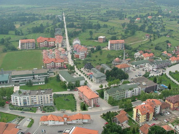
Map of Divič
Interactive Map
Recent Nearby Earthquakes
Magnitude 3.0 and greater
| Date▼ | Time↕ | Magnitude↕ | Distance↕ | Depth↕ | Location↕ | Link |
|---|---|---|---|---|---|---|
| 7/21/19 | 9:07 AM | 4.2 | 97.3 km | 10,000 m | 8km SSE of Cajnice, Bosnia and Herzegovina | usgs.gov |
| 7/21/19 | 7:05 AM | 4.2 | 64.8 km | 10,000 m | 4km WSW of Srebrenik, Bosnia and Herzegovina | usgs.gov |
| 4/12/15 | 12:05 AM | 4.1 | 80 km | 3,600 m | 5km S of Koran, Bosnia and Herzegovina | usgs.gov |
| 3/8/15 | 8:47 PM | 4.4 | 70.9 km | 9,020 m | 16km S of Valjevo, Serbia | usgs.gov |
| 2/21/15 | 9:21 PM | 3.6 | 22.6 km | 3,100 m | 7km ESE of Tojsici, Bosnia and Herzegovina | usgs.gov |
| 3/18/10 | 5:28 PM | 4 | 63.7 km | 2,000 m | Bosnia and Herzegovina | usgs.gov |
| 3/31/09 | 1:46 AM | 4.1 | 82.8 km | 5,000 m | Bosnia and Herzegovina | usgs.gov |
| 3/30/09 | 1:27 PM | 3.9 | 67.3 km | 2,000 m | Bosnia and Herzegovina | usgs.gov |
| 9/20/08 | 12:05 AM | 3.1 | 99.3 km | 12,700 m | Serbia | usgs.gov |
| 9/19/08 | 11:19 AM | 3.5 | 93.9 km | 2,600 m | Serbia | usgs.gov |
Source: U.S. Geological Survey (USGS)
Divič
Divič is a village by the city of Zvornik, Bosnia and Herzegovina. It is located on the Drina River, by an artificial lake created to form a reservoir for the HPP Zvornik hydro-electric power plant. The Drina River and the lake are a natural and admi..
Divič Wikipedia Page


About Our Data
The data on this page is estimated using a number of publicly available tools and resources. It is provided without warranty, and could contain inaccuracies. Use at your own risk.