Categories in Zbraslav (Brno-Country District)
Industries
Business Distribution by Industry in Zbraslav (Brno-Country District)
| Industry Description | Number of Establishments | Average Google Rating |
|---|---|---|
| Shopping | 72 | 3.5 |
| Health and medical | 38 | 4 |
| Education | 23 | 4.3 |
| Restaurants | 23 | 4.5 |
| Car repair | 16 | 4.6 |
| Technical construction services | 14 | 3 |
| Household appliances and goods | 12 | 4.6 |
| Beauty salons | 11 | 4.4 |
| Other accommodation | 10 | 4.1 |
| Pharmacies and drug stores | 10 | 3.8 |
| Hotels and motels | 10 | 4.1 |
| All food and beverage | 10 | 4.3 |
| Grocery stores and supermarkets | 9 | 3 |
| Accountants | 9 | — |
| Construction of buildings | 9 | 5 |
| General contractors | 9 | — |
| Hospitals | 9 | 4.2 |
| Bars, pubs and taverns | 9 | 4.3 |
| Dentists | 8 | 4.1 |
| General practitioners | 8 | 4.9 |
| Preschools and kindergartens | 8 | 4.6 |
| Travel agencies | 7 | 4.2 |
| Wholesale of construction supplies | 6 | 3.9 |
| Hearing | 6 | 5 |
| Lawyers legal | 6 | — |
Zbraslav (Brno-Country District) Facts
| Area | 0.9 km² |
| Population | 901 |
| Male Population | 454 (50.4%) |
| Female Population | 447 (49.6%) |
| Population change (1975 to 2020) | +27.8% |
| Population change (2000 to 2020) | +17.5% |
| Median Age | 40.3 years (Male: 38.8, Female: 42.4) |
| Neighborhoods | Praha-Zbraslav, Zbraslav, Praha 16, Praha, Praha 5 |
| Local Time | |
| Timezone | Central European Summer Time |
| Lat & Lng | 49.22155, 16.29415 |
Map of Zbraslav (Brno-Country District)
Interactive Map
Zbraslav (Brno-Country District) Population
Years 1975 to 2020
| Data | 1975 | 1990 | 2000 | 2015 | 2020 |
|---|---|---|---|---|---|
| Population | 705 | 705 | 767 | 902 | 901 |
| Population Density | 805.7 / km² | 805.7 / km² | 876.6 / km² | 1,030.9 / km² | 1,029.7 / km² |
Zbraslav (Brno-Country District) Population change from 2000 to 2015
Increase of 17.6% from year 2000 to 2015
| Location | Change since 1975 | Change since 1990 | Change since 2000 |
|---|---|---|---|
| Zbraslav (Brno-Country District) | +27.9% | +27.9% | +17.6% |
| South Moravian Region | +9.1% | +3.8% | +3.2% |
| Czech Republic | +4.8% | +2.1% | +2.7% |
Zbraslav (Brno-Country District) Median Age
Median Age: 40.3 years
| Location | Median Age | Median Age (Female) | Median Age (Male) |
|---|---|---|---|
| Zbraslav (Brno-Country District) | 40.3 yrs | 42.4 yrs | 38.8 yrs |
| South Moravian Region | 39.8 yrs | 41.7 yrs | 38.4 yrs |
| Czech Republic | 40 yrs | 41.7 yrs | 38.7 yrs |
Zbraslav (Brno-Country District) Population Density
Population Density: 1,030 / km²
| Location | Population | Area | Density |
|---|---|---|---|
| Zbraslav (Brno-Country District) | 901 | 0.875 km² | 1,030 / km² |
| South Moravian Region | 1.2 million | 7,195.7 km² | 164 / km² |
| Czech Republic | 10.5 million | 78,907.6 km² | 134 / km² |
Zbraslav (Brno-Country District) Historical and Projected Population
Estimated Population from 0 to 2100
- JRC (European Commission's Joint Research Centre) work on the GHS built-up grid
- CIESIN (Center for International Earth Science Information Network)
- [Link] Klein Goldewijk, K., Beusen, A., Doelman, J., and Stehfest, E.: Anthropogenic land use estimates for the Holocene – HYDE 3.2, Earth Syst. Sci. Data, 9, 927–953, https://doi.org/10.5194/essd-9-927-2017, 2017.
Neighborhoods in Zbraslav (Brno-Country District)
Percentage of businesses by neighborhood in Zbraslav (Brno-Country District)
Area Codes
Percentage Area Codes used by businesses in Zbraslav (Brno-Country District)
Postal Codes
Percentage of businesses by Postal Codes in Zbraslav (Brno-Country District)
Price Distribution
Business distribution by price for Zbraslav (Brno-Country District)
Human Development Index (HDI)
Statistic composite index of life expectancy, education, and per capita income.
Zbraslav (Brno-Country District) CO2 Emissions
Carbon Dioxide (CO2) Emissions Per Capita in Tonnes Per Year
| Location | CO2 Emissions | CO2 Emissions Per Capita | CO2 Emissions Intensity |
|---|---|---|---|
| Zbraslav (Brno-Country District) | 8,265 tn | 9.17 tn | 9,445.7 tons/km² |
| South Moravian Region | 10,852,546 tn | 9.22 tn | 1,508.2 tons/km² |
| Czech Republic | 95,143,045 tn | 9.02 tn | 1,205.8 tons/km² |
| 2013 CO2 emissions (tonnes/year) | 8,265 tn |
| 2013 CO2 emissions (tonnes/year) per capita | 9.17 tn |
| 2013 CO2 emissions intensity (tonnes/km²/year) | 9,445.7 tons/km² |
Natural Hazards Risk
Relative risk out of 10
| Hazard | Risk Level |
|---|---|
| Flood | Medium (7) |
* Risk, particularly concerning flood or landslide, may not be for the entire area.
- Dilley, M., R.S. Chen, U. Deichmann, A.L. Lerner-Lam, M. Arnold, J. Agwe, P. Buys, O. Kjekstad, B. Lyon, and G. Yetman. 2005. Natural Disaster Hotspots: A Global Risk Analysis. Washington, D.C.: World Bank. https://doi.org/10.1596/0-8213-5930-4.
- Center for Hazards and Risk Research - CHRR - Columbia University, Center for International Earth Science Information Network - CIESIN - Columbia University. 2005. Global Flood Hazard Frequency and Distribution. Palisades, NY: NASA Socioeconomic Data and Applications Center (SEDAC). https://doi.org/10.7927/H4668B3D.
Recent Nearby Earthquakes
Magnitude 3.0 and greater
| Date▼ | Time↕ | Magnitude↕ | Distance↕ | Depth↕ | Location↕ | Link |
|---|---|---|---|---|---|---|
| 3/21/06 | 4:26 PM | 3 | 46.8 km | 5,000 m | Czech Republic | usgs.gov |
| 9/28/88 | 1:43 PM | 3.2 | 56.1 km | 10,000 m | Czech Republic | usgs.gov |
| 3/2/88 | 10:29 AM | 3 | 58.6 km | 10,000 m | Czech Republic | usgs.gov |
| 7/9/87 | 12:15 PM | 3.5 | 59.6 km | 5,000 m | Czech Republic | usgs.gov |
| 7/2/86 | 11:59 AM | 3.1 | 57.4 km | 10,000 m | Czech Republic | usgs.gov |
| 6/14/85 | 11:50 AM | 3.9 | 50.8 km | 0 m | Czech Republic | usgs.gov |
| 2/20/85 | 12:58 PM | 3.2 | 57.7 km | 10,000 m | Czech Republic | usgs.gov |
| 3/22/84 | 12:14 PM | 3.9 | 57.8 km | 10,000 m | Czech Republic | usgs.gov |
| 2/25/83 | 1:00 PM | 3.5 | 62.8 km | 10,000 m | Czech Republic | usgs.gov |
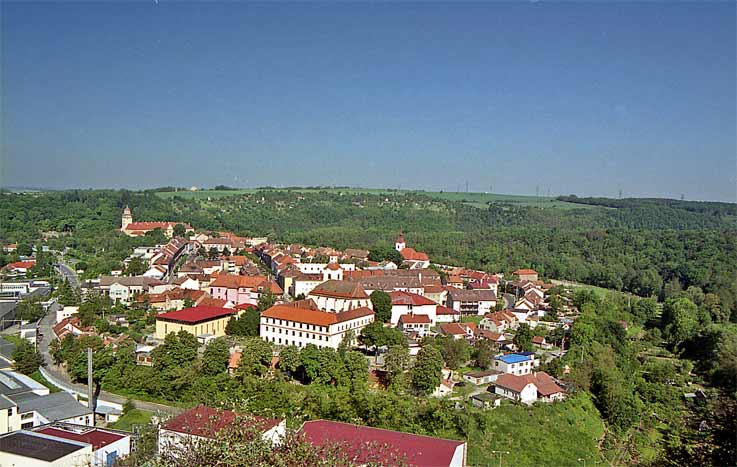
Zbraslav (Brno-Country District)
Zbraslav is a village and municipality (obec) in Brno-Country District in the South Moravian Region of the Czech Republic. municipality covers an area of 8.94 square kilometres (3.45 sq mi), and has a population of 1,203 (as at 3 July 2006). lies a..
Zbraslav (Brno-Country District) Wikipedia Page_3030_2304.jpeg "Image of Zbraslav (Brno-Country District)")


About Our Data
The data on this page is estimated using a number of publicly available tools and resources. It is provided without warranty, and could contain inaccuracies. Use at your own risk.