Categories in Eskilstrup
FarmingAssociation or OrganizationChurchesBricklayerCarpenterGeneral contractorsRestaurantsLandscaperHolding CompanyHair SalonConsulting & Advisory ServicesWindow Cleaning ServiceReal Estate AgencyResidential Property RentalsSports AssociationSports clubBed and breakfastsElectric Vehicle Charging Station
Industries
Business Distribution by Industry in Eskilstrup
| Industry Description | Number of Establishments |
|---|---|
| Construction of buildings | 23 |
| Landscaping | 22 |
| Kitchen and bath cabinets and remodel | 12 |
| All food and beverage | 12 |
| Artists and musicians | 9 |
| General cleaning services | 8 |
| Unreachable | 7 |
| Massage | 7 |
| Sports clubs | 7 |
| Other membership organizations | 7 |
| Car repair | 6 |
Eskilstrup Facts
| Area | 0.9 km² |
| Population | 816 |
| Population change (1975 to 2020) | -4.2% |
| Population change (2000 to 2020) | -1.2% |
| Local Time | |
| Timezone | Central European Summer Time |
| Lat & Lng | 54.85574, 11.88668 |
| Postal Codes | 4863 |
Map of Eskilstrup
Interactive Map
Eskilstrup Population
Years 1975 to 2020
| Data | 1975 | 1990 | 2000 | 2015 | 2020 |
|---|---|---|---|---|---|
| Population | 852 | 857 | 826 | 796 | 816 |
| Population Density | 973.7 / km² | 979.4 / km² | 944 / km² | 909.7 / km² | 932.6 / km² |
Sources: JRC (European Commission's Joint Research Centre) work on the GHS built-up grid
Eskilstrup Population change from 2000 to 2015
Decrease of 3.6% from year 2000 to 2015
| Location | Change since 1975 | Change since 1990 | Change since 2000 |
|---|---|---|---|
| Eskilstrup | -6.6% | -7.1% | -3.6% |
| Region Zealand | +2.2% | +1.7% | +0.6% |
| Denmark | +12.1% | +10.4% | +6.3% |
Sources: JRC (European Commission's Joint Research Centre) work on the GHS built-up grid
Eskilstrup Population Density
Population Density: 933 / km²
| Location | Population | Area | Density |
|---|---|---|---|
| Eskilstrup | 816 | 0.875 km² | 933 / km² |
| Region Zealand | 802,458 | 7,343.5 km² | 109 / km² |
| Denmark | 5.5 million | 43,072 km² | 129 / km² |
Sources: JRC (European Commission's Joint Research Centre) work on the GHS built-up grid
Eskilstrup Historical and Projected Population
Estimated Population from 0 to 2100
Sources:
- JRC (European Commission's Joint Research Centre) work on the GHS built-up grid
- CIESIN (Center for International Earth Science Information Network)
- [Link] Klein Goldewijk, K., Beusen, A., Doelman, J., and Stehfest, E.: Anthropogenic land use estimates for the Holocene – HYDE 3.2, Earth Syst. Sci. Data, 9, 927–953, https://doi.org/10.5194/essd-9-927-2017, 2017.
Price Distribution
Business distribution by price for Eskilstrup
Human Development Index (HDI)
Statistic composite index of life expectancy, education, and per capita income.
Source: [Link] Kummu, M., Taka, M. &Guillaume, J. Gridded global datasets for Gross Domestic Product and Human Development Index over 1990–2015. Sci Data 5, 180004 (2018) doi:10.1038/sdata.2018.4
Eskilstrup CO2 Emissions
Carbon Dioxide (CO2) Emissions Per Capita in Tonnes Per Year
| Location | CO2 Emissions | CO2 Emissions Per Capita | CO2 Emissions Intensity |
|---|---|---|---|
| Eskilstrup | 8,841 tn | 10.83 tn | 10,104.3 tons/km² |
| Region Zealand | 8,459,301 tn | 10.54 tn | 1,151.9 tons/km² |
| Denmark | 59,647,725 tn | 10.75 tn | 1,384.8 tons/km² |
Sources: [Link] Moran, D., Kanemoto K; Jiborn, M., Wood, R., Többen, J., and Seto, K.C. (2018) Carbon footprints of 13,000 cities. Environmental Research Letters DOI: 10.1088/1748-9326/aac72a
Eskilstrup CO2 Emissions
| 2013 CO2 emissions (tonnes/year) | 8,841 tn |
| 2013 CO2 emissions (tonnes/year) per capita | 10.83 tn |
| 2013 CO2 emissions intensity (tonnes/km²/year) | 10,104.3 tons/km² |
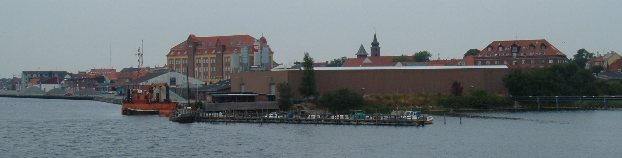
Eskilstrup
Eskilstrup is a town some 12 kilometres (7.5 mi) north of Nykobing Falster on the Danish island of Falster. As of 2015, it has a population of 1,082.
Eskilstrup Wikipedia Page


About Our Data
The data on this page is estimated using a number of publicly available tools and resources. It is provided without warranty, and could contain inaccuracies. Use at your own risk.