Five Roads Facts
| Local Time | |
| Timezone | Greenwich Mean Time |
| Lat & Lng | 51.72639, -4.18861 |
Map of Five Roads
Interactive Map
Recent Nearby Earthquakes
Magnitude 3.0 and greater
| Date▼ | Time↕ | Magnitude↕ | Distance↕ | Depth↕ | Location↕ | Link |
|---|---|---|---|---|---|---|
| 2/17/18 | 2:31 PM | 4.3 | 23 km | 11,550 m | 5km NE of Clydach, United Kingdom | usgs.gov |
| 2/20/14 | 1:21 PM | 4.1 | 40.5 km | 3,000 m | 17km NNW of Ilfracombe, United Kingdom | usgs.gov |
| 6/20/02 | 5:26 PM | 3.4 | 78.7 km | 14,300 m | Wales-England region, United Kingdom | usgs.gov |
| 2/12/02 | 7:13 PM | 3.5 | 64.6 km | 8,300 m | Wales-England region, United Kingdom | usgs.gov |
| 1/28/02 | 12:30 AM | 3 | 73.3 km | 10,000 m | Wales-England region, United Kingdom | usgs.gov |
| 10/10/01 | 2:52 AM | 3.5 | 70.8 km | 10,000 m | Wales-England region, United Kingdom | usgs.gov |
| 5/31/01 | 11:42 PM | 4 | 88.4 km | 28,700 m | England, United Kingdom | usgs.gov |
| 10/25/99 | 7:15 PM | 4.5 | 46.4 km | 10,000 m | Wales-England region, United Kingdom | usgs.gov |
| 7/30/99 | 9:31 AM | 3.3 | 68.4 km | 6,400 m | Wales-England region, United Kingdom | usgs.gov |
| 1/1/94 | 3:17 AM | 3.6 | 72.2 km | 10,000 m | Wales-England region, United Kingdom | usgs.gov |
Source: U.S. Geological Survey (USGS)
Five Roads
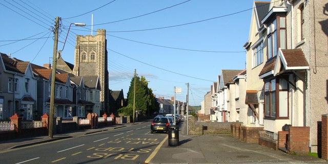
Five Roads (Welsh: Pum Heol) is a hamlet in Carmarthenshire, Wales near the town of Llanelli. is situated on the B4309 Llanelli to Carmarthen road, about five miles from the former and ten miles from the latter. name of the village comes from the f..
Five Roads Wikipedia Page


About Our Data
The data on this page is estimated using a number of publicly available tools and resources. It is provided without warranty, and could contain inaccuracies. Use at your own risk.