Categories in Halifax, West Yorkshire
Industries
Business Distribution by Industry in Halifax, West Yorkshire
| Industry Description | Number of Establishments | Average Age of Business | Average Google Rating |
|---|---|---|---|
| Shopping | 973 | 32 years | 4.1 |
| Restaurants | 318 | 23 years | 4.2 |
| General contractors | 230 | 30 years | 4.2 |
| Bars, pubs and taverns | 199 | 26 years | 4.2 |
| All food and beverage | 177 | 24 years | 4.2 |
| Car repair | 176 | 28 years | 4.2 |
| Grocery stores and supermarkets | 162 | 24 years | 4.1 |
| Education | 162 | 37 years | 4.1 |
| Beauty salons | 132 | 21 years | 4.7 |
| Health and medical | 127 | — | 3.6 |
| Household appliances and goods | 126 | 36 years | 3.9 |
| Shopping other | 124 | 26 years | 4.1 |
| Wholesale of machinery | 109 | 35 years | 4 |
| Corporate management | 101 | 27 years | 3.4 |
| Hairdressers | 99 | — | 4.6 |
| Hardware store | 98 | 31 years | 4.2 |
| Tractors and farm equipment | 95 | — | 4.4 |
| Other construction | 95 | 36 years | 3.9 |
| Technical construction services | 88 | 37 years | 4.4 |
| Cafes | 87 | — | 4.4 |
| Electronics stores | 84 | 28 years | 4 |
| Street vendors | 83 | — | 3.8 |
| Real estate | 81 | 25 years | 4.3 |
| Loan companies | 78 | 26 years | 3.8 |
| Clothing stores | 76 | — | 4.1 |
Halifax, West Yorkshire Facts
| Area | 72.1 km² |
| Population | 101,527 |
| Male Population | 49,830 (49.1%) |
| Female Population | 51,697 (50.9%) |
| Population change (1975 to 2020) | +13.7% |
| Population change (2000 to 2020) | +11.2% |
| Median Age | 38 years (Male: 37.2, Female: 38.7) |
| Area Codes | 1422 |
| Neighborhoods | Greetland, Hipperholme, Town Centre, Northowram, Luddenden Foot |
| Local Time | |
| Timezone | British Summer Time |
| Lat & Lng | 53.71667, -1.85000 |
| Postal Codes | HD6, HX1, HX2, HX3, HX4, More |
Map of Halifax, West Yorkshire
Interactive Map
Halifax, West Yorkshire Population
Years 1975 to 2020
| Data | 1975 | 1990 | 2000 | 2015 | 2020 |
|---|---|---|---|---|---|
| Population | 89,282 | 89,627 | 91,290 | 98,110 | 101,527 |
| Population Density | 1,237.9 / km² | 1,242.7 / km² | 1,265.7 / km² | 1,360.3 / km² | 1,407.7 / km² |
Halifax, West Yorkshire Population change from 2000 to 2015
Increase of 7.5% from year 2000 to 2015
| Location | Change since 1975 | Change since 1990 | Change since 2000 |
|---|---|---|---|
| Halifax, West Yorkshire | +9.9% | +9.5% | +7.5% |
| United Kingdom | +15.2% | +13.3% | +9.9% |
Halifax, West Yorkshire Median Age
Median Age: 38 years
| Location | Median Age | Median Age (Female) | Median Age (Male) |
|---|---|---|---|
| Halifax, West Yorkshire | 38 yrs | 38.7 yrs | 37.2 yrs |
| United Kingdom | 39.6 yrs | 40.6 yrs | 38.5 yrs |
Halifax, West Yorkshire Population Density
Population Density: 1,408 / km²
| Location | Population | Area | Density |
|---|---|---|---|
| Halifax, West Yorkshire | 101,527 | 72.1 km² | 1,408 / km² |
| United Kingdom | 64.5 million | 247,916.6 km² | 260 / km² |
Halifax, West Yorkshire Historical and Projected Population
Estimated Population from 1200 to 2100
- JRC (European Commission's Joint Research Centre) work on the GHS built-up grid
- CIESIN (Center for International Earth Science Information Network)
- [Link] Klein Goldewijk, K., Beusen, A., Doelman, J., and Stehfest, E.: Anthropogenic land use estimates for the Holocene – HYDE 3.2, Earth Syst. Sci. Data, 9, 927–953, https://doi.org/10.5194/essd-9-927-2017, 2017.
Neighborhoods in Halifax, West Yorkshire
Percentage of businesses by neighborhood in Halifax, West Yorkshire
Area Codes
Percentage Area Codes used by businesses in Halifax, West Yorkshire
Postal Codes
Percentage of businesses by Postal Codes in Halifax, West Yorkshire
Price Distribution
Business distribution by price for Halifax, West Yorkshire
Human Development Index (HDI)
Statistic composite index of life expectancy, education, and per capita income.
Halifax, West Yorkshire CO2 Emissions
Carbon Dioxide (CO2) Emissions Per Capita in Tonnes Per Year
| Location | CO2 Emissions | CO2 Emissions Per Capita | CO2 Emissions Intensity |
|---|---|---|---|
| Halifax, West Yorkshire | 1,154,019 tn | 11.37 tn | 16,000.3 tons/km² |
| United Kingdom | 735,672,544 tn | 11.4 tn | 2,967.4 tons/km² |
| 2013 CO2 emissions (tonnes/year) | 1,154,019 tn |
| 2013 CO2 emissions (tonnes/year) per capita | 11.37 tn |
| 2013 CO2 emissions intensity (tonnes/km²/year) | 16,000.3 tons/km² |
Natural Hazards Risk
Relative risk out of 10
| Hazard | Risk Level |
|---|---|
| Flood | High (10) |
| Earthquake | Low (2) |
* Risk, particularly concerning flood or landslide, may not be for the entire area.
- Dilley, M., R.S. Chen, U. Deichmann, A.L. Lerner-Lam, M. Arnold, J. Agwe, P. Buys, O. Kjekstad, B. Lyon, and G. Yetman. 2005. Natural Disaster Hotspots: A Global Risk Analysis. Washington, D.C.: World Bank. https://doi.org/10.1596/0-8213-5930-4.
- Center for Hazards and Risk Research - CHRR - Columbia University, Center for International Earth Science Information Network - CIESIN - Columbia University. 2005. Global Flood Hazard Frequency and Distribution. Palisades, NY: NASA Socioeconomic Data and Applications Center (SEDAC). https://doi.org/10.7927/H4668B3D.
- Center for Hazards and Risk Research - CHRR - Columbia University, Center for International Earth Science Information Network - CIESIN - Columbia University. 2005. Global Earthquake Hazard Distribution - Peak Ground Acceleration. Palisades, NY: NASA Socioeconomic Data and Applications Center (SEDAC). https://doi.org/10.7927/H4BZ63ZS.
Recent Nearby Earthquakes
Magnitude 3.0 and greater
| Date▼ | Time↕ | Magnitude↕ | Distance↕ | Depth↕ | Location↕ | Link |
|---|---|---|---|---|---|---|
| 1/3/11 | 9:03 PM | 3.6 | 52 km | 6,000 m | England, United Kingdom | usgs.gov |
| 4/28/09 | 10:22 AM | 3.7 | 91.6 km | 8,800 m | England, United Kingdom | usgs.gov |
| 7/5/04 | 10:17 PM | 3 | 85.7 km | 9,500 m | England, United Kingdom | usgs.gov |
| 2/29/04 | 5:08 AM | 3.4 | 19.5 km | 12,400 m | England, United Kingdom | usgs.gov |
| 8/19/03 | 7:46 PM | 3.2 | 61.3 km | 13,200 m | England, United Kingdom | usgs.gov |
| 10/29/02 | 4:42 AM | 3.1 | 34.9 km | 5,000 m | England, United Kingdom | usgs.gov |
| 10/24/02 | 8:24 AM | 3.8 | 33.8 km | 3,700 m | England, United Kingdom | usgs.gov |
| 10/23/02 | 1:53 AM | 3.3 | 33.5 km | 5,000 m | England, United Kingdom | usgs.gov |
| 10/22/02 | 12:28 PM | 3.5 | 33.5 km | 4,200 m | England, United Kingdom | usgs.gov |
| 10/21/02 | 11:42 AM | 4.3 | 36.1 km | 5,000 m | England, United Kingdom | usgs.gov |
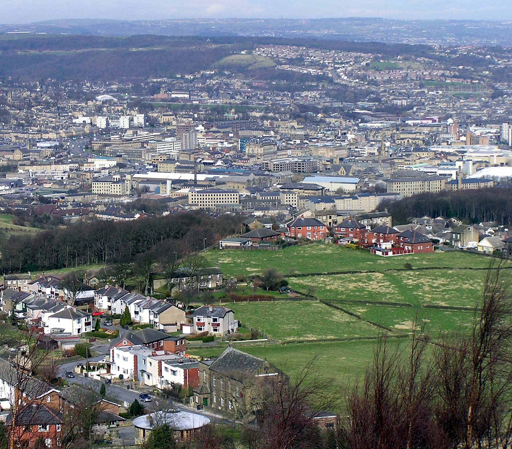
Halifax, West Yorkshire
is a minster town, in the Metropolitan Borough of Calderdale in West Yorkshire, England. The town has been a centre of woollen manufacture from the 15th century onward, originally dealing through the Piece Hall. Halifax is known for Mackintosh's ch..
Halifax, West Yorkshire Wikipedia Page

About Our Data
The data on this page is estimated using a number of publicly available tools and resources. It is provided without warranty, and could contain inaccuracies. Use at your own risk.