Industries
Business Distribution by Industry in Peroj
| Industry Description | Number of Establishments |
|---|---|
| Other accommodation | 55 |
| Real estate | 24 |
| Holiday homes, cabins and resorts | 22 |
| Apartments | 14 |
| Hotels and motels | 8 |
| Restaurants | 7 |
| Bars, pubs and taverns | 7 |
| Churches | 6 |
Peroj Facts
| Local Time | |
| Timezone | Central European Summer Time |
| Lat & Lng | 44.95194, 13.79694 |
Map of Peroj
Interactive Map
Area Codes
Percentage Area Codes used by businesses in Peroj
Postal Codes
Percentage of businesses by Postal Codes in Peroj
Price Distribution
Business distribution by price for Peroj
Recent Nearby Earthquakes
Magnitude 3.0 and greater
| Date▼ | Time↕ | Magnitude↕ | Distance↕ | Depth↕ | Location↕ | Link |
|---|---|---|---|---|---|---|
| 8/8/17 | 9:35 AM | 4 | 69.5 km | 10,000 m | 3km E of Omisalj, Croatia | usgs.gov |
| 4/22/14 | 8:58 AM | 4.5 | 83.9 km | 4,600 m | 6km SE of Pivka, Slovenia | usgs.gov |
| 12/23/08 | 7:07 PM | 3.6 | 50.5 km | 10,000 m | Adriatic Sea | usgs.gov |
| 10/21/08 | 8:12 AM | 3.4 | 84.6 km | 10,000 m | Slovenia | usgs.gov |
| 10/6/08 | 9:19 AM | 3.3 | 63.7 km | 10,000 m | Slovenia-Croatia border region | usgs.gov |
| 8/13/07 | 1:58 PM | 3.9 | 39.5 km | 8,900 m | Italy-Slovenia-Croatia border region | usgs.gov |
| 6/10/07 | 8:48 PM | 3.2 | 71.8 km | 10,000 m | Croatia | usgs.gov |
| 12/29/06 | 2:14 AM | 3.4 | 83.7 km | 10,000 m | Adriatic Sea | usgs.gov |
| 6/22/06 | 7:44 AM | 3.4 | 88.3 km | 9,500 m | Adriatic Sea | usgs.gov |
| 4/24/05 | 6:34 PM | 4.4 | 77.2 km | 10,000 m | Slovenia | usgs.gov |
Source: U.S. Geological Survey (USGS)
Peroj
Peroj (Italian: Peroi) is a village in the Vodnjan municipality on the south-western coast of Istria, Croatia. Peroj originally dates back to the Copper age of prehistory, as testified by a necropolis within the old walls of the town. The town has be..
Peroj Wikipedia Page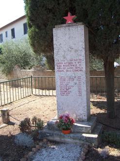


About Our Data
The data on this page is estimated using a number of publicly available tools and resources. It is provided without warranty, and could contain inaccuracies. Use at your own risk.