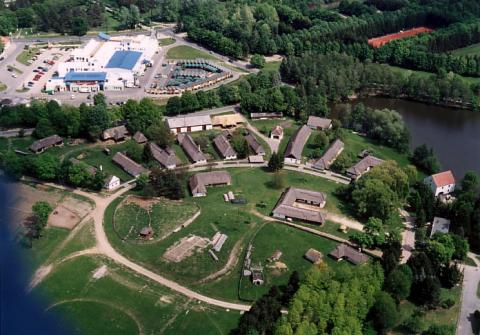
Bucsu Facts
| Area | 19.9 km² |
| Population | 560 |
| Male Population | 277 (49.4%) |
| Female Population | 283 (50.6%) |
| Population change (1975 to 2020) | -6.2% |
| Population change (2000 to 2020) | -7.9% |
| Median Age | 40.5 years (Male: 40, Female: 41.2) |
| Local Time | |
| Timezone | Central European Summer Time |
| Lat & Lng | 47.26528, 16.49354 |
| Postal Codes | 9792 |
Map of Bucsu
Interactive Map
Bucsu Population
Years 1975 to 2020
| Data | 1975 | 1990 | 2000 | 2015 | 2020 |
|---|---|---|---|---|---|
| Population | 597 | 616 | 608 | 566 | 560 |
| Population Density | 30 / km² | 31 / km² | 30.6 / km² | 28.5 / km² | 28.2 / km² |
Bucsu Population change from 2000 to 2015
Decrease of 6.9% from year 2000 to 2015
| Location | Change since 1975 | Change since 1990 | Change since 2000 |
|---|---|---|---|
| Bucsu | -5.2% | -8.1% | -6.9% |
| Vas County | -9.3% | -9.2% | -7.1% |
| Hungary | -6.5% | -5.1% | -3.6% |
Bucsu Median Age
Median Age: 40.5 years
| Location | Median Age | Median Age (Female) | Median Age (Male) |
|---|---|---|---|
| Bucsu | 40.5 yrs | 41.2 yrs | 40 yrs |
| Vas County | 42.3 yrs | 44.6 yrs | 40.1 yrs |
| Hungary | 40.8 yrs | 43.2 yrs | 38.6 yrs |
Bucsu Population Density
Population Density: 28.2 / km²
| Location | Population | Area | Density |
|---|---|---|---|
| Bucsu | 560 | 19.9 km² | 28.2 / km² |
| Vas County | 250,914 | 3,336.8 km² | 75.2 / km² |
| Hungary | 9.8 million | 93,010.9 km² | 106 / km² |
Bucsu Historical and Projected Population
Estimated Population from 0 to 2100
- JRC (European Commission's Joint Research Centre) work on the GHS built-up grid
- CIESIN (Center for International Earth Science Information Network)
- [Link] Klein Goldewijk, K., Beusen, A., Doelman, J., and Stehfest, E.: Anthropogenic land use estimates for the Holocene – HYDE 3.2, Earth Syst. Sci. Data, 9, 927–953, https://doi.org/10.5194/essd-9-927-2017, 2017.
Human Development Index (HDI)
Statistic composite index of life expectancy, education, and per capita income.
Bucsu CO2 Emissions
Carbon Dioxide (CO2) Emissions Per Capita in Tonnes Per Year
| Location | CO2 Emissions | CO2 Emissions Per Capita | CO2 Emissions Intensity |
|---|---|---|---|
| Bucsu | 2,672 tn | 4.77 tn | 134.5 tons/km² |
| Vas County | 1,181,965 tn | 4.71 tn | 354.2 tons/km² |
| Hungary | 48,384,016 tn | 4.92 tn | 520.2 tons/km² |
| 2013 CO2 emissions (tonnes/year) | 2,672 tn |
| 2013 CO2 emissions (tonnes/year) per capita | 4.77 tn |
| 2013 CO2 emissions intensity (tonnes/km²/year) | 134.5 tons/km² |
Natural Hazards Risk
Relative risk out of 10
| Hazard | Risk Level |
|---|---|
| Earthquake | Low (2) |
* Risk, particularly concerning flood or landslide, may not be for the entire area.
- Dilley, M., R.S. Chen, U. Deichmann, A.L. Lerner-Lam, M. Arnold, J. Agwe, P. Buys, O. Kjekstad, B. Lyon, and G. Yetman. 2005. Natural Disaster Hotspots: A Global Risk Analysis. Washington, D.C.: World Bank. https://doi.org/10.1596/0-8213-5930-4.
- Center for Hazards and Risk Research - CHRR - Columbia University, Center for International Earth Science Information Network - CIESIN - Columbia University. 2005. Global Earthquake Hazard Distribution - Peak Ground Acceleration. Palisades, NY: NASA Socioeconomic Data and Applications Center (SEDAC). https://doi.org/10.7927/H4BZ63ZS.
Recent Nearby Earthquakes
Magnitude 3.0 and greater
| Date▼ | Time↕ | Magnitude↕ | Distance↕ | Depth↕ | Location↕ | Link |
|---|---|---|---|---|---|---|
| 4/25/16 | 10:28 AM | 4.2 | 95.2 km | 3,460 m | 3km NNE of Heiligenkreuz, Austria | usgs.gov |
| 10/2/13 | 5:17 PM | 3.6 | 77.7 km | 11,550 m | 2km SW of Mitterndorf an der Fischa, Austria | usgs.gov |
| 9/20/13 | 2:06 AM | 4.2 | 73.2 km | 14,570 m | 1km SSE of Leithaprodersdorf, Austria | usgs.gov |
| 5/7/09 | 9:27 PM | 4.2 | 70.1 km | 11,900 m | Austria | usgs.gov |
| 12/7/08 | 2:47 AM | 3.9 | 69.7 km | 10,000 m | Austria | usgs.gov |
| 6/3/08 | 7:42 PM | 3.1 | 91.1 km | 6,600 m | Austria | usgs.gov |
| 2/26/08 | 7:57 PM | 3.9 | 58.3 km | 10,000 m | Austria | usgs.gov |
| 1/30/08 | 2:54 PM | 3.8 | 55.2 km | 10,000 m | Austria | usgs.gov |
| 8/19/07 | 10:57 PM | 3 | 94 km | 9,800 m | Hungary | usgs.gov |
| 3/3/07 | 8:35 PM | 3 | 30.1 km | 10,000 m | Hungary | usgs.gov |
Bucsu
Bucsu (German: Butsching, Croatian: Bučura, Buča) is a village in Vas County, Hungary, in the vicinity of Szombathely. It is on the border with Austria, and there is a road crossing the border from Bucsu to Rechnitz and Schachendorf. historical cent..
Bucsu Wikipedia Page

About Our Data
The data on this page is estimated using a number of publicly available tools and resources. It is provided without warranty, and could contain inaccuracies. Use at your own risk.