Paperu Facts
| Local Time | |
| Timezone | Eastern Indonesia Time |
| Lat & Lng | -3.59226, 128.65850 |
Map of Paperu
Interactive Map
Recent Nearby Earthquakes
Magnitude 3.0 and greater
| Date▼ | Time↕ | Magnitude↕ | Distance↕ | Depth↕ | Location↕ | Link |
|---|---|---|---|---|---|---|
| 3/26/19 | 10:16 PM | 4.2 | 35 km | 129,000 m | 37km SSE of Saparua, Indonesia | usgs.gov |
| 11/1/18 | 4:33 PM | 4.4 | 39.7 km | 96,470 m | 41km SE of Saparua, Indonesia | usgs.gov |
| 2/24/18 | 3:15 PM | 4.2 | 43.1 km | 128,740 m | 38km SSE of Amahai, Indonesia | usgs.gov |
| 11/25/17 | 10:50 AM | 4.5 | 34 km | 117,890 m | 36km SSW of Saparua, Indonesia | usgs.gov |
| 7/1/17 | 5:14 PM | 4.6 | 26.4 km | 122,800 m | 28km SSW of Saparua, Indonesia | usgs.gov |
| 6/6/17 | 12:52 AM | 4 | 39.1 km | 113,570 m | 41km SSE of Saparua, Indonesia | usgs.gov |
| 8/24/16 | 12:04 AM | 3.9 | 36.4 km | 57,230 m | 20km SSE of Amahai, Indonesia | usgs.gov |
| 12/28/15 | 4:26 PM | 5.2 | 37.1 km | 50,740 m | 17km SE of Passo, Indonesia | usgs.gov |
| 8/17/15 | 8:48 PM | 4 | 33.8 km | 46,320 m | 35km ESE of Saparua, Indonesia | usgs.gov |
| 8/17/15 | 8:38 AM | 4 | 15.8 km | 35,000 m | 16km E of Saparua, Indonesia | usgs.gov |
Source: U.S. Geological Survey (USGS)
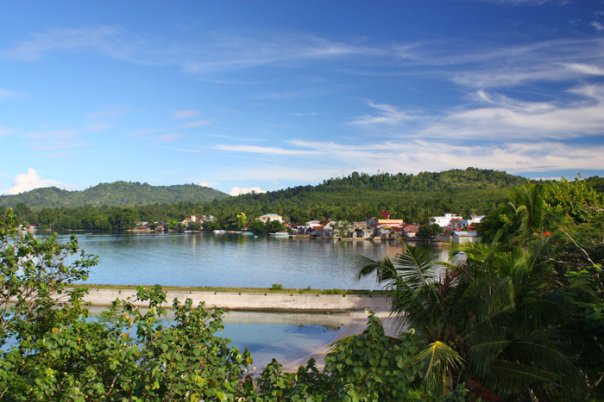
Paperu
Paperu, Indonesia, is a village on the island of Saparua, which is a part of the Ambon island group in the Maluku Islands.
Paperu Wikipedia Page
About Our Data
The data on this page is estimated using a number of publicly available tools and resources. It is provided without warranty, and could contain inaccuracies. Use at your own risk.