Dewalthal Facts
| Local Time | |
| Timezone | India Standard Time |
| Lat & Lng | 29.69214, 80.20630 |
Map of Dewalthal
Interactive Map
Recent Nearby Earthquakes
Magnitude 3.0 and greater
| Date▼ | Time↕ | Magnitude↕ | Distance↕ | Depth↕ | Location↕ | Link |
|---|---|---|---|---|---|---|
| 11/11/18 | 7:07 AM | 4.5 | 49.8 km | 10,000 m | 13km NE of Dharchula, India | usgs.gov |
| 12/1/16 | 4:52 PM | 5.2 | 52 km | 31,960 m | 17km NNE of Dharchula, India | usgs.gov |
| 7/2/16 | 12:23 AM | 4.4 | 88.6 km | 10,000 m | 31km NNE of Dipayal, Nepal | usgs.gov |
| 9/29/15 | 9:27 AM | 4.6 | 37.4 km | 35,000 m | 22km NW of Darchula, Nepal | usgs.gov |
| 8/5/15 | 7:15 PM | 4.1 | 75.7 km | 10,000 m | 60km NNW of Darchula, Nepal | usgs.gov |
| 1/22/15 | 3:42 AM | 4 | 88.8 km | 40,660 m | 17km NE of Dipayal, Nepal | usgs.gov |
| 8/24/14 | 8:29 AM | 4.4 | 45.2 km | 10,000 m | 27km NE of Bageshwar, India | usgs.gov |
| 7/6/14 | 2:48 PM | 4.1 | 71.1 km | 43,730 m | 55km NNW of Dharchula, India | usgs.gov |
| 7/3/14 | 11:35 AM | 4 | 62.6 km | 35,000 m | 47km NNW of Dharchula, India | usgs.gov |
| 7/28/12 | 5:48 AM | 4.6 | 49.6 km | 16,500 m | Nepal-India border region | usgs.gov |
Source: U.S. Geological Survey (USGS)
Dewalthal
Dewalthal is a tehsil of Pithoragarh District in Uttarakhand state, in northern India. It has a population of 5,000 India,and has a treasury, bank, post office, government, private school, rest house. name Dewalthal is derived from two words, Dew an..
Dewalthal Wikipedia Page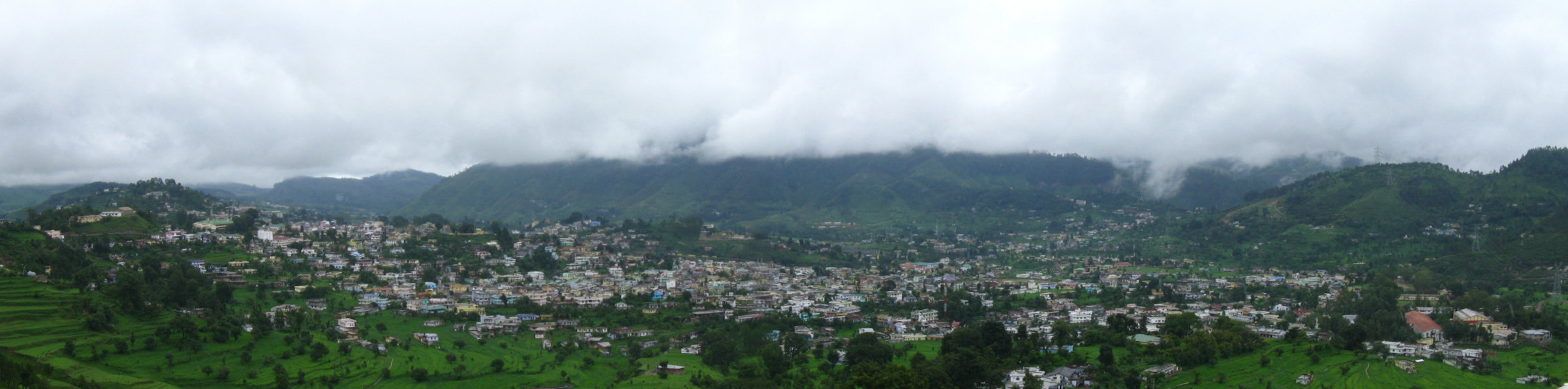

About Our Data
The data on this page is estimated using a number of publicly available tools and resources. It is provided without warranty, and could contain inaccuracies. Use at your own risk.