Industries
Business Distribution by Industry in Bampur
| Industry Description | Number of Establishments |
|---|---|
| Shopping | 9 |
Bampur Facts
| Local Time | |
| Timezone | Iran Standard Time |
| Lat & Lng | 27.19439, 60.45594 |
Map of Bampur
Interactive Map
Recent Nearby Earthquakes
Magnitude 3.0 and greater
| Date▼ | Time↕ | Magnitude↕ | Distance↕ | Depth↕ | Location↕ | Link |
|---|---|---|---|---|---|---|
| 10/12/17 | 12:28 PM | 4.1 | 62 km | 10,000 m | 63km NNW of Iranshahr, Iran | usgs.gov |
| 9/21/16 | 7:41 AM | 4.5 | 71.2 km | 10,000 m | 93km WSW of Iranshahr, Iran | usgs.gov |
| 5/17/16 | 12:03 AM | 4 | 60.7 km | 10,000 m | 75km SW of Iranshahr, Iran | usgs.gov |
| 3/28/15 | 5:03 PM | 4.3 | 81.4 km | 53,890 m | 59km E of Iranshahr, Iran | usgs.gov |
| 12/27/13 | 8:06 AM | 4.1 | 89.6 km | 10,000 m | 73km SE of Iranshahr, Iran | usgs.gov |
| 9/30/13 | 3:44 AM | 4.6 | 21.8 km | 15,500 m | 34km SW of Iranshahr, Iran | usgs.gov |
| 6/19/13 | 4:26 PM | 4.2 | 50.3 km | 10,500 m | 68km WSW of Iranshahr, Iran | usgs.gov |
| 5/1/13 | 10:18 PM | 4 | 50.6 km | 44,400 m | 47km N of Iranshahr, Iran | usgs.gov |
| 11/29/09 | 3:25 AM | 4.4 | 76.4 km | 10,000 m | southeastern Iran | usgs.gov |
| 4/21/07 | 10:01 PM | 4.2 | 23.4 km | 18,000 m | southeastern Iran | usgs.gov |
Source: U.S. Geological Survey (USGS)
Bampur
Bampur (Persian: بمپور, also Romanized as Bampūr and Bampoor) is a city in and capital of Bampur County, Sistan and Baluchestan Province, Iran. At the 2006 census, its population was 9,073, in 1,664 families. is located 330 miles (530 km) south-ea..
Bampur Wikipedia Page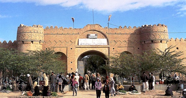
About Our Data
The data on this page is estimated using a number of publicly available tools and resources. It is provided without warranty, and could contain inaccuracies. Use at your own risk.