Categories in Karasf
Industries
Business Distribution by Industry in Karasf
Karasf Facts
| Local Time | |
| Timezone | Iran Standard Time |
| Lat & Lng | 36.04480, 48.50500 |
Map of Karasf
Interactive Map
Recent Nearby Earthquakes
Magnitude 3.0 and greater
| Date▼ | Time↕ | Magnitude↕ | Distance↕ | Depth↕ | Location↕ | Link |
|---|---|---|---|---|---|---|
| 11/2/16 | 11:11 AM | 4.2 | 59.5 km | 10,000 m | 60km SSW of Abhar, Iran | usgs.gov |
| 3/2/15 | 6:08 AM | 4.5 | 51.1 km | 8,000 m | 50km SSW of Abhar, Iran | usgs.gov |
| 1/13/12 | 12:35 PM | 4.3 | 56.6 km | 5,000 m | western Iran | usgs.gov |
| 4/28/10 | 8:04 PM | 4.2 | 53.5 km | 14,200 m | western Iran | usgs.gov |
| 1/10/10 | 6:52 AM | 4.1 | 56.8 km | 4,000 m | western Iran | usgs.gov |
| 9/26/08 | 11:00 AM | 4.3 | 65.1 km | 10,000 m | western Iran | usgs.gov |
| 5/27/08 | 6:18 AM | 4.9 | 68.6 km | 23,000 m | northwestern Iran | usgs.gov |
| 3/27/08 | 6:48 AM | 4 | 66.7 km | 15,000 m | western Iran | usgs.gov |
| 12/19/07 | 3:27 PM | 4 | 52 km | 10,000 m | western Iran | usgs.gov |
| 5/22/07 | 11:53 AM | 4.1 | 84.5 km | 3,000 m | western Iran | usgs.gov |
Source: U.S. Geological Survey (USGS)
Karasf
Karasf (Persian: كرسف, also Romanized as Karsof; also known as Karafs and Qarasf) is a City in Karasf Rural District, in the Khodabandeh County, Zanjan Province, Iran. At the 2006 census, its population was 2,869, in 753 families. and in 2012 was 4..
Karasf Wikipedia Page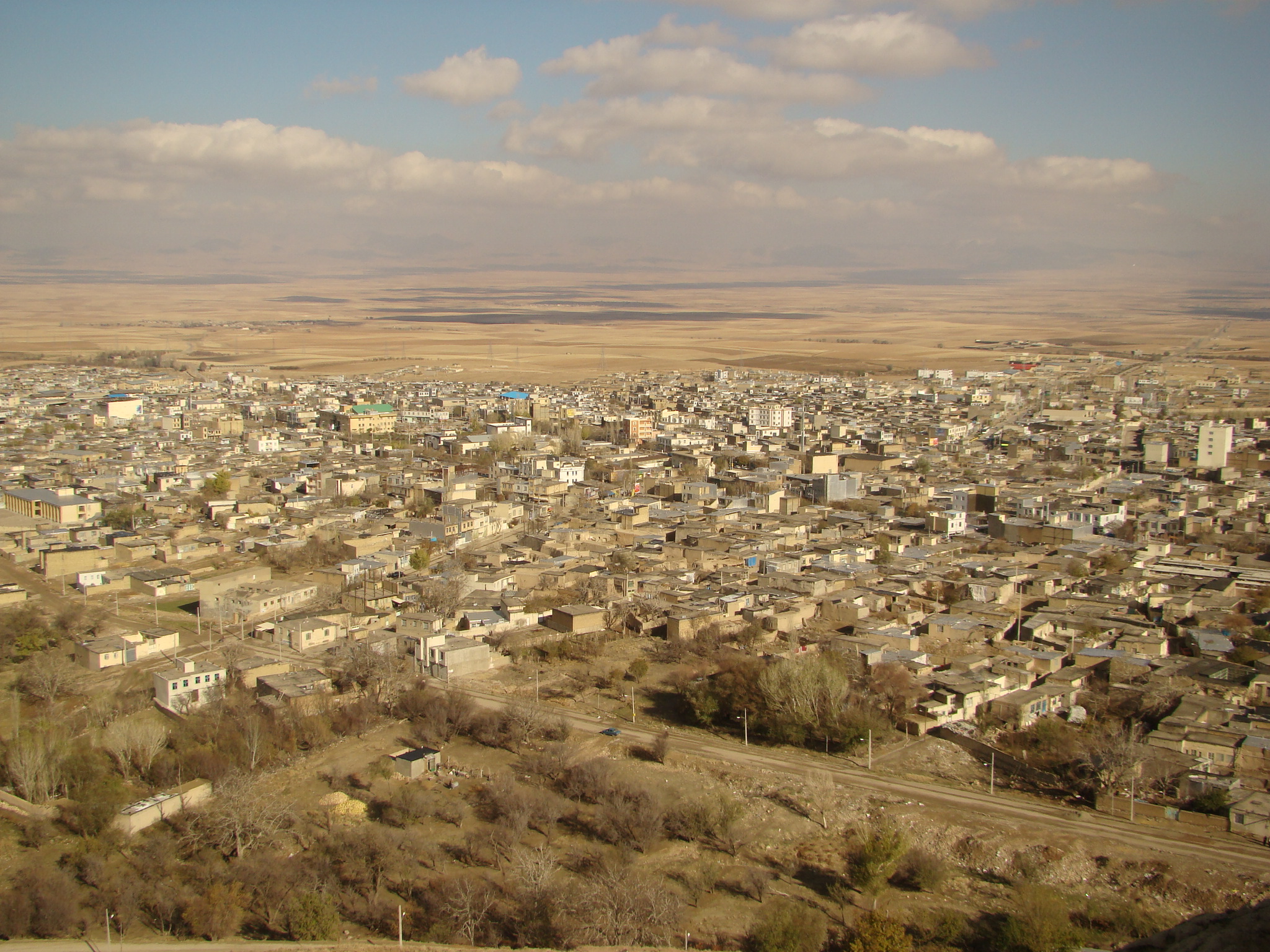
About Our Data
The data on this page is estimated using a number of publicly available tools and resources. It is provided without warranty, and could contain inaccuracies. Use at your own risk.