Categories in Bislig
Industries
Business Distribution by Industry in Bislig
| Industry Description | Number of Establishments |
|---|---|
| Public administration | 77 |
| Education | 64 |
| Restaurants | 34 |
| Loan companies | 32 |
| Shopping | 20 |
| Religion | 19 |
| Banks | 18 |
| Radio broadcasting | 15 |
| Business services | 15 |
| Other accommodation | 13 |
| Bakeries | 10 |
| Health and medical | 10 |
| Cafes | 10 |
| Clothing stores | 10 |
| Corporate management | 10 |
Bislig Facts
| Area | 319.5 km² |
| Population | 85,085 |
| Male Population | 43,934 (51.6%) |
| Female Population | 41,151 (48.4%) |
| Population change (1975 to 2020) | +26.7% |
| Population change (2000 to 2020) | -19.8% |
| Median Age | 22.3 years (Male: 22.2, Female: 22.4) |
| GDP per capita (PPP) | $5,054 (2022) |
| Neighborhoods | Mangagoy, Baesa, San Isidro, Loyola Heights |
| Local Time | |
| Timezone | Philippine Standard Time |
| Lat & Lng | 8.21528, 126.31639 |
| Zip Codes | 8311 |
Map of Bislig
Interactive Map
Bislig Population
Years 1975 to 2030
| Data | 1975 | 1990 | 2000 | 2015 | 2020 | 2025* | 2030* |
|---|---|---|---|---|---|---|---|
| Population | 67,138 | 104,256 | 106,139 | 84,946 | 85,085 | 88,703 | 91,635 |
| Population Density | 210.1 / km² | 326.3 / km² | 332.2 / km² | 265.9 / km² | 266.3 / km² | 277.6 / km² | 286.8 / km² |
Bislig Population change from 2000 to 2020
Decrease of 19.8% from year 2000 to 2020
| Location | Change since 1975 | Change since 1990 | Change since 2000 |
|---|---|---|---|
| Bislig | +26.7% | -18.4% | -19.8% |
| Philippines | — | — | — |
Bislig Median Age
Median Age: 22.3 years
| Location | Median Age | Median Age (Female) | Median Age (Male) |
|---|---|---|---|
| Bislig | 22.3 yrs | 22.4 yrs | 22.2 yrs |
| Philippines | 23.2 yrs | 23.6 yrs | 22.8 yrs |
Bislig Population Density
Population Density: 266 / km²
| Location | Population | Area | Density |
|---|---|---|---|
| Bislig | 85,085 | 319.5 km² | 266 / km² |
| Philippines | 96.6 million | 296,939.4 km² | 325 / km² |
Bislig Historical and Projected Population
Estimated Population from 1600 to 2100
- JRC (European Commission's Joint Research Centre) work on the GHS built-up grid
- CIESIN (Center for International Earth Science Information Network)
- [Link] Klein Goldewijk, K., Beusen, A., Doelman, J., and Stehfest, E.: Anthropogenic land use estimates for the Holocene – HYDE 3.2, Earth Syst. Sci. Data, 9, 927–953, https://doi.org/10.5194/essd-9-927-2017, 2017.
Area Codes
Percentage Area Codes used by businesses in Bislig
Price Distribution
Business distribution by price for Bislig
Human Development Index (HDI)
Statistic composite index of life expectancy, education, and per capita income.
Bislig Gross Domestic Product (GDP)
GDP per capita, PPP (constant 2017 international $)
| Data | 1990 | 1995 | 2000 | 2005 | 2010 | 2015 | 2020 | 2022 |
|---|---|---|---|---|---|---|---|---|
| GDP per capita | $1,452 | $1,445 | $1,411 | $2,214 | $2,478 | $3,997 | $4,174 | $5,054 |
| Total GDP | $54M | $48.2M | $55.1M | $85.9M | $92.1M | $156.5M | $147.9M | $203.1M |
Bislig CO2 Emissions
Carbon Dioxide (CO2) Emissions Per Capita in Tonnes Per Year
| Location | CO2 Emissions | CO2 Emissions Per Capita | CO2 Emissions Intensity |
|---|---|---|---|
| Bislig | 84,199 tn | 0.99 tn | 263.5 tons/km² |
| Philippines | 104,920,564 tn | 1.09 tn | 353.3 tons/km² |
| 2013 CO2 emissions (tonnes/year) | 84,199 tn |
| 2013 CO2 emissions (tonnes/year) per capita | 0.99 tn |
| 2013 CO2 emissions intensity (tonnes/km²/year) | 263.5 tons/km² |
Natural Hazards Risk
Relative risk out of 10
| Hazard | Risk Level |
|---|---|
| Drought | Medium (4) |
| Flood | High (10) |
| Earthquake | High (8.2) |
| Cyclone | High (9) |
| Landslide | Medium (6) |
* Risk, particularly concerning flood or landslide, may not be for the entire area.
- Dilley, M., R.S. Chen, U. Deichmann, A.L. Lerner-Lam, M. Arnold, J. Agwe, P. Buys, O. Kjekstad, B. Lyon, and G. Yetman. 2005. Natural Disaster Hotspots: A Global Risk Analysis. Washington, D.C.: World Bank. https://doi.org/10.1596/0-8213-5930-4.
- Center for Hazards and Risk Research - CHRR - Columbia University, Center for International Earth Science Information Network - CIESIN - Columbia University, and Norwegian Geotechnical Institute - NGI. 2005. Global Landslide Hazard Distribution. Palisades, NY: NASA Socioeconomic Data and Applications Center (SEDAC). https://doi.org/10.7927/H4P848VZ.
- Center for Hazards and Risk Research - CHRR - Columbia University, Center for International Earth Science Information Network - CIESIN - Columbia University, International Bank for Reconstruction and Development - The World Bank, and United Nations Environment Programme Global Resource Information Database Geneva - UNEP/GRID-Geneva. 2005. Global Cyclone Hazard Frequency and Distribution. Palisades, NY: NASA Socioeconomic Data and Applications Center (SEDAC). https://doi.org/10.7927/H4CZ353K.
- Center for Hazards and Risk Research - CHRR - Columbia University, Center for International Earth Science Information Network - CIESIN - Columbia University, and International Research Institute for Climate and Society - IRI - Columbia University. 2005. Global Drought Hazard Frequency and Distribution. Palisades, NY: NASA Socioeconomic Data and Applications Center (SEDAC). https://doi.org/10.7927/H4VX0DFT.
- Center for Hazards and Risk Research - CHRR - Columbia University, Center for International Earth Science Information Network - CIESIN - Columbia University. 2005. Global Flood Hazard Frequency and Distribution. Palisades, NY: NASA Socioeconomic Data and Applications Center (SEDAC). https://doi.org/10.7927/H4668B3D.
- Center for Hazards and Risk Research - CHRR - Columbia University, Center for International Earth Science Information Network - CIESIN - Columbia University. 2005. Global Earthquake Hazard Distribution - Peak Ground Acceleration. Palisades, NY: NASA Socioeconomic Data and Applications Center (SEDAC). https://doi.org/10.7927/H4BZ63ZS.
Recent Nearby Earthquakes
Magnitude 3.0 and greater
| Date▼ | Time↕ | Magnitude↕ | Distance↕ | Depth↕ | Location↕ | Link |
|---|---|---|---|---|---|---|
| 6/28/19 | 5:51 PM | 4.4 | 22.9 km | 44,120 m | 8km ESE of Barcelona, Philippines | usgs.gov |
| 6/28/19 | 10:12 AM | 4.5 | 25.7 km | 35,520 m | 9km NE of Libertad, Philippines | usgs.gov |
| 4/21/19 | 11:01 AM | 4.2 | 22.5 km | 97,800 m | 5km NNE of Hinatuan, Philippines | usgs.gov |
| 10/29/18 | 9:36 PM | 4.3 | 22.3 km | 89,480 m | 9km SE of Tagbina, Philippines | usgs.gov |
| 7/2/18 | 3:27 PM | 4.2 | 15.2 km | 174,220 m | 13km SW of Bigaan, Philippines | usgs.gov |
| 6/21/18 | 3:25 AM | 4.6 | 17.9 km | 121,490 m | 13km E of Tidman, Philippines | usgs.gov |
| 6/28/17 | 3:21 PM | 4.4 | 31.6 km | 54,660 m | 20km ENE of Barcelona, Philippines | usgs.gov |
| 6/16/17 | 1:44 AM | 4.9 | 26.8 km | 81,440 m | 19km NE of Barcelona, Philippines | usgs.gov |
| 3/28/17 | 10:08 AM | 4.6 | 25.2 km | 10,000 m | 9km ENE of Libertad, Philippines | usgs.gov |
| 9/23/16 | 7:50 PM | 4.5 | 32.5 km | 44,670 m | 6km ESE of Rosario, Philippines | usgs.gov |
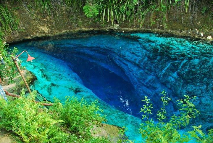
Bislig
Bislig, officially called the City of Bislig and often referred to as Bislig City, is a third income class city in the province of Surigao del Sur, Mindanao, Philippines. According to the 2010 census, it has a population of 96,578 people. Mangagoy, ..
Bislig Wikipedia Page


About Our Data
The data on this page is estimated using a number of publicly available tools and resources. It is provided without warranty, and could contain inaccuracies. Use at your own risk.