Categories in Rafah
Rafah Facts
| Area | 0.1 km² |
| Population | 4,479 |
| Male Population | 2,260 (50.4%) |
| Female Population | 2,219 (49.6%) |
| Population change (2000 to 2020) | +1684.5% |
| Median Age | 15.7 years (Male: 15.7, Female: 15.7) |
| GDP per capita (PPP) | $15,762 (2022) |
| Local Time | |
| Timezone | Eastern European Summer Time |
| Lat & Lng | 31.28700, 34.25952 |
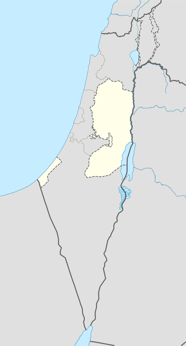
Map of Rafah
Interactive Map
Rafah Population
Years 1975 to 2030
| Data | 1975 | 1990 | 2000 | 2015 | 2020 | 2025* | 2030* |
|---|---|---|---|---|---|---|---|
| Population | 0 | 135 | 251 | 377 | 4,479 | 4,534 | 4,533 |
| Population Density | 0 / km² | 2,160 / km² | 4,016 / km² | 6,032 / km² | 71,664 / km² | 72,544 / km² | 72,528 / km² |
Rafah Population change from 2000 to 2020
Increase of 1684.5% from year 2000 to 2020
| Location | Change since 1975 | Change since 1990 | Change since 2000 |
|---|---|---|---|
| Rafah | — | +3217.8% | +1684.5% |
| Gaza Strip | — | — | — |
| State of Palestine | — | — | — |
Rafah Median Age
Median Age: 15.7 years
| Location | Median Age | Median Age (Female) | Median Age (Male) |
|---|---|---|---|
| Rafah | 15.7 yrs | 15.7 yrs | 15.7 yrs |
| Gaza Strip | 15.8 yrs | 15.7 yrs | 15.8 yrs |
| State of Palestine | 17.8 yrs | 18 yrs | 17.7 yrs |
Rafah Population Density
Population Density: 71,664 / km²
| Location | Population | Area | Density |
|---|---|---|---|
| Rafah | 4,479 | 62,500 m² | 71,664 / km² |
| Gaza Strip | 1.7 million | 367.3 km² | 4,723 / km² |
| State of Palestine | 4.4 million | 6,106.7 km² | 722 / km² |
Rafah Historical and Projected Population
Estimated Population from 0 to 2100
- JRC (European Commission's Joint Research Centre) work on the GHS built-up grid
- CIESIN (Center for International Earth Science Information Network)
- [Link] Klein Goldewijk, K., Beusen, A., Doelman, J., and Stehfest, E.: Anthropogenic land use estimates for the Holocene – HYDE 3.2, Earth Syst. Sci. Data, 9, 927–953, https://doi.org/10.5194/essd-9-927-2017, 2017.
Price Distribution
Business distribution by price for Rafah
Rafah Gross Domestic Product (GDP)
GDP per capita, PPP (constant 2017 international $)
| Data | 1990 | 1995 | 2000 | 2005 | 2010 | 2015 | 2020 | 2022 |
|---|---|---|---|---|---|---|---|---|
| GDP per capita | $8,444 | $8,745 | $9,753 | $9,690 | $11,836 | $11,642 | $14,484 | $15,762 |
| Total GDP | $527.8M | $604M | $763.8M | $878.9M | $1.2B | $1.3B | $1.7B | $1.9B |
Rafah CO2 Emissions
Carbon Dioxide (CO2) Emissions Per Capita in Tonnes Per Year
| Location | CO2 Emissions | CO2 Emissions Per Capita | CO2 Emissions Intensity |
|---|---|---|---|
| Rafah | 4,887 tn | 1.09 tn | 78,188.8 tons/km² |
| Gaza Strip | 2,143,861 tn | 1.24 tn | 5,837.5 tons/km² |
| State of Palestine | 5,551,278 tn | 1.26 tn | 909.1 tons/km² |
| 2013 CO2 emissions (tonnes/year) | 4,887 tn |
| 2013 CO2 emissions (tonnes/year) per capita | 1.09 tn |
| 2013 CO2 emissions intensity (tonnes/km²/year) | 78,188.8 tons/km² |
Natural Hazards Risk
Relative risk out of 10
| Hazard | Risk Level |
|---|---|
| Flood | Medium (4) |
| Earthquake | Medium (4) |
* Risk, particularly concerning flood or landslide, may not be for the entire area.
- Dilley, M., R.S. Chen, U. Deichmann, A.L. Lerner-Lam, M. Arnold, J. Agwe, P. Buys, O. Kjekstad, B. Lyon, and G. Yetman. 2005. Natural Disaster Hotspots: A Global Risk Analysis. Washington, D.C.: World Bank. https://doi.org/10.1596/0-8213-5930-4.
- Center for Hazards and Risk Research - CHRR - Columbia University, Center for International Earth Science Information Network - CIESIN - Columbia University. 2005. Global Flood Hazard Frequency and Distribution. Palisades, NY: NASA Socioeconomic Data and Applications Center (SEDAC). https://doi.org/10.7927/H4668B3D.
- Center for Hazards and Risk Research - CHRR - Columbia University, Center for International Earth Science Information Network - CIESIN - Columbia University. 2005. Global Earthquake Hazard Distribution - Peak Ground Acceleration. Palisades, NY: NASA Socioeconomic Data and Applications Center (SEDAC). https://doi.org/10.7927/H4BZ63ZS.
Recent Nearby Earthquakes
Magnitude 3.0 and greater
| Date▼ | Time↕ | Magnitude↕ | Distance↕ | Depth↕ | Location↕ | Link |
|---|---|---|---|---|---|---|
| 11/23/07 | 10:19 PM | 4.4 | 90.6 km | 11,000 m | Dead Sea region | usgs.gov |
| 8/2/93 | 11:16 PM | 4.1 | 97.2 km | 10,000 m | Dead Sea region | usgs.gov |
| 9/13/90 | 12:10 PM | 3.9 | 78.9 km | 10,000 m | Dead Sea region | usgs.gov |
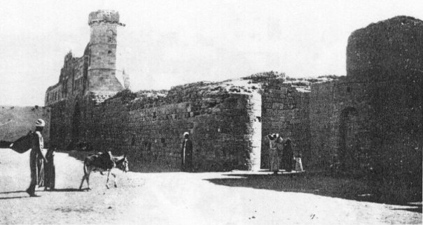
Rafah
Rafah (Arabic: رفح) is a Palestinian city and refugee camp in the southern Gaza Strip. It is the district capital of the Rafah Governorate, located 30 kilometers (19 mi) south of Gaza City. Rafah's population of 152,950 (2014) is overwhelmingly made..
Rafah Wikipedia Page

About Our Data
The data on this page is estimated using a number of publicly available tools and resources. It is provided without warranty, and could contain inaccuracies. Use at your own risk.