Businesses in Pechora
Hotels & Travel
Restaurants
Automotive
Financial Services
Medical
Beauty & Spas
Community & Government
Industries
Business Distribution by Industry Shopping: 17.6%
Industry: 17.3%
Hotels & Travel: 8.2%
Professional Services: 7.3%
Home Services: 6.8%
Restaurants: 6.4%
Food: 5.4%
Community & Government: 5.3%
Automotive: 5.2%
Financial Services: 5.2%
Other: 15.1%
| Industry Description | Number of Establishments | Average Google Rating | Businesses per 1,000 residents |
|---|---|---|---|
| Gas stations | 5 | 5.0 | 0.5 |
| Public administration | 5 | 1.0 | 0.5 |
| Banks | 6 | 3.9 | 0.7 |
| Convenience stores | 6 | 0.7 | |
| Real estate | 15 | 5.0 | 1.6 |
| Hotels and motels | 7 | 4.1 | 0.8 |
| Construction of buildings | 8 | 5.0 | 0.9 |
| Hospitals | 11 | 3.7 | 1.2 |
| Post offices | 6 | 4.2 | 0.7 |
| Cafes | 9 | 4.1 | 1.0 |
| Electronics stores | 7 | 4.4 | 0.8 |
| Mobile phone stores | 8 | 4.4 | 0.9 |
| Office supplies and stationery stores | 11 | 1.2 | |
| Shopping other | 9 | 4.1 | 1.0 |
| Public parks | 5 | 0.5 |
| Area of Pechora, Komi Republic | 7.9 km² |
| Population | 9,220 |
| Population change from 1975 to 2015 | -36.8% |
| Population change from 2000 to 2015 | -25.2% |
| Local Time | Thursday 3:35 PM |
| Timezone | Moscow Standard Time |
| Lat & Lng | 65.14717° / 57.22439° |
| Postal Codes | 169600, 169601, 169606, 169607, 169609 |
Pechora, Komi Republic - Map
Pechora, Komi Republic Population
Years 1975 to 2015| Data | 1975 | 1990 | 2000 | 2015 |
|---|---|---|---|---|
| Population | 14,581 | 14,664 | 12,334 | 9,220 |
| Population Density | 1,835 / km² | 1,845 / km² | 1,552 / km² | 1,160 / km² |
Pechora Population change from 2000 to 2015
Decrease of 25.2% from year 2000 to 2015| Location | Change since 1975 | Change since 1990 | Change since 2000 |
|---|---|---|---|
| Pechora, Komi Republic | -36.8% | -37.1% | -25.2% |
| Komi | -35.5% | -30% | -19.9% |
| Russia | +7.1% | -2.9% | -2% |
Pechora, Komi Republic Population Density
Population Density: 1,160 / km²| Location | Population | Area | Population Density |
|---|---|---|---|
| Pechora, Komi Republic | 9,220 | 7.9 km² | 1,160 / km² |
| Komi | 844,660 | 418,035.7 km² | 2.02 / km² |
| Russia | 145.3 million | 16,974,452.8 km² | 8.56 / km² |
Pechora, Komi Republic Historical and Projected Population
Estimated Population from 1820 to 2100Sources:
1. JRC (European Commission's Joint Research Centre) work on the GHS built-up grid
2. CIESIN (Center for International Earth Science Information Network)
3. [Link] Klein Goldewijk, K., Beusen, A., Doelman, J., and Stehfest, E.: Anthropogenic land use estimates for the Holocene – HYDE 3.2, Earth Syst. Sci. Data, 9, 927–953, https://doi.org/10.5194/essd-9-927-2017, 2017.
Area Codes
Percentage Area Codes used by businesses in Pechora Area Code 821: 60.4%
Area Code 800: 21.7%
Area Code 9: 17%
Other: 0.9%
Business distribution by price for Pechora, Komi Republic
Inexpensive: 60.9%
Moderate: 26.1%
Expensive: 13%
Human Development Index (HDI)
Statistic composite index of life expectancy, education, and per capita income.Sources: [Link] Kummu, M., Taka, M. & Guillaume, J. Gridded global datasets for Gross Domestic Product and Human Development Index over 1990–2015. Sci Data 5, 180004 (2018) doi:10.1038/sdata.2018.4
Pechora, Komi Republic CO2 Emissions
Carbon Dioxide (CO2) Emissions Per Capita in Tonnes Per Year| Location | CO2 Emissions | CO2 Emissions Per Capita | CO2 Emissions Intensity |
|---|---|---|---|
| Pechora, Komi Republic | 102,663 tn | 11.1 tn | 12,921 tons/km² |
| Komi | 8,408,550 tn | 9.95 tn | 20.1 tons/km² |
| Russia | 1,356,388,646 tn | 9.34 tn | 79.9 tons/km² |
Pechora, Komi Republic CO2 Emissions
| 2013 CO2 emissions (tonnes/year) | 102,663 tn |
| 2013 CO2 emissions (tonnes/year) per capita | 11.1 tn |
| 2013 CO2 emissions intensity (tonnes/km²/year) | 12,921 tons/km² |
Recent Nearby Earthquakes
Magnitude 3.0 and greater| Date | Time | Magnitude | Distance | Depth | Location | Link |
|---|---|---|---|---|---|---|
| 8/11/84 | 11:59 AM | 5.3 | 96.8 km | None | Ural Mountains region, Russia | usgs.gov |

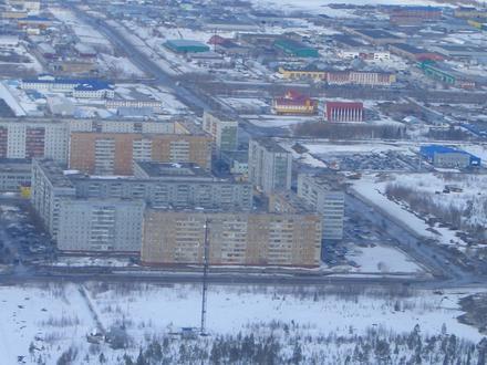
Pechora, Komi Republic
Pechora (Russian: Печо́ра; Komi: Печӧра, Pečöra) is a town in the Komi Republic, Russia, located on the Pechora River, near the northern Ural Mountains. Population: 43,105 (2010 Census); 48,700 (2002 Census); 64,746 (1989 Census). Pechora Wikipedia Page
Postal Codes
Percentage of businesses by Postal Codes in Pechora Postal Code 169600: 64.1%
Postal Code 169601: 23.9%
Postal Code 169607: 7.7%
Other: 4.3%

About Our Data
The data on this page is estimated using a number of publicly available tools and resources. It is provided without warranty, and could contain inaccuracies. Use at your own risk. See here for more information.