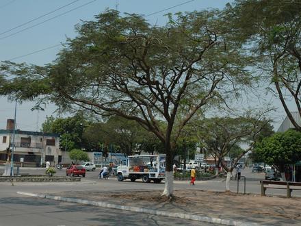
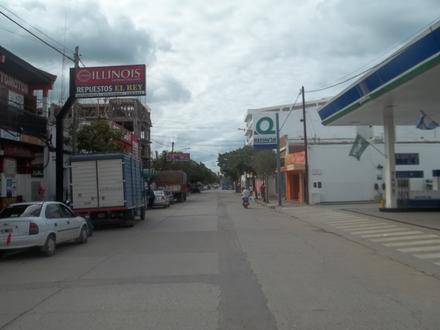
Businesses in Caimancito
| Area of Caimancito, Jujuy Province | 0.787 km² |
| Population | 2,717 |
| Population change from 1975 to 2015 | +100.2% |
| Population change from 2000 to 2015 | +5.6% |
| Area Codes | 3886 |
| Local Time | Monday 4:50 PM |
| Timezone | Argentina Standard Time |
| Lat & Lng | -23.74069° / -64.5937° |
Caimancito, Jujuy Province - Map
Caimancito, Jujuy Province Population
Years 1975 to 2015| Data | 1975 | 1990 | 2000 | 2015 |
|---|---|---|---|---|
| Population | 1,357 | 2,420 | 2,572 | 2,717 |
| Population Density | 1,723 / km² | 3,073 / km² | 3,266 / km² | 3,450 / km² |
Caimancito Population change from 2000 to 2015
Increase of 5.6% from year 2000 to 2015| Location | Change since 1975 | Change since 1990 | Change since 2000 |
|---|---|---|---|
| Caimancito, Jujuy Province | +100.2% | +12.3% | +5.6% |
| Jujuy | +66.3% | +31.1% | +15.8% |
| Argentina | +66.4% | +32.6% | +17.1% |
Caimancito, Jujuy Province Population Density
Population Density: 3,450 / km²| Location | Population | Area | Population Density |
|---|---|---|---|
| Caimancito, Jujuy Province | 2,717 | 0.787 km² | 3,450 / km² |
| Jujuy | 721,918 | 53,326.2 km² | 13.5 / km² |
| Argentina | 43.2 million | 2,779,516.9 km² | 15.5 / km² |
Caimancito, Jujuy Province Historical and Projected Population
Estimated Population from 1830 to 2100Sources:
1. JRC (European Commission's Joint Research Centre) work on the GHS built-up grid
2. CIESIN (Center for International Earth Science Information Network)
3. [Link] Klein Goldewijk, K., Beusen, A., Doelman, J., and Stehfest, E.: Anthropogenic land use estimates for the Holocene – HYDE 3.2, Earth Syst. Sci. Data, 9, 927–953, https://doi.org/10.5194/essd-9-927-2017, 2017.
Human Development Index (HDI)
Statistic composite index of life expectancy, education, and per capita income.Sources: [Link] Kummu, M., Taka, M. & Guillaume, J. Gridded global datasets for Gross Domestic Product and Human Development Index over 1990–2015. Sci Data 5, 180004 (2018) doi:10.1038/sdata.2018.4
Caimancito, Jujuy Province CO2 Emissions
Carbon Dioxide (CO2) Emissions Per Capita in Tonnes Per Year| Location | CO2 Emissions | CO2 Emissions Per Capita | CO2 Emissions Intensity |
|---|---|---|---|
| Caimancito, Jujuy Province | 11,656 tn | 4.29 tn | 14,802 tons/km² |
| Jujuy | 2,734,121 tn | 3.79 tn | 51.3 tons/km² |
| Argentina | 198,107,944 tn | 4.59 tn | 71.3 tons/km² |
Caimancito, Jujuy Province CO2 Emissions
| 2013 CO2 emissions (tonnes/year) | 11,656 tn |
| 2013 CO2 emissions (tonnes/year) per capita | 4.29 tn |
| 2013 CO2 emissions intensity (tonnes/km²/year) | 14,802 tons/km² |
Natural Hazards Risk
Relative risk out of 10| Flood | Medium (4) |
| Earthquake | Medium (6) |
* Risk, particularly concerning flood or landslide, may not be for the entire area.
Sources: 1. Dilley, M., R.S. Chen, U. Deichmann, A.L. Lerner-Lam, M. Arnold, J. Agwe, P. Buys, O. Kjekstad, B. Lyon, and G. Yetman. 2005. Natural Disaster Hotspots: A Global Risk Analysis. Washington, D.C.: World Bank. https://doi.org/10.1596/0-8213-5930-4.
2. Center for Hazards and Risk Research - CHRR - Columbia University, Center for International Earth Science Information Network - CIESIN - Columbia University. 2005. Global Flood Hazard Frequency and Distribution. Palisades, NY: NASA Socioeconomic Data and Applications Center (SEDAC). https://doi.org/10.7927/H4668B3D.
3. Center for Hazards and Risk Research - CHRR - Columbia University, Center for International Earth Science Information Network - CIESIN - Columbia University. 2005. Global Earthquake Hazard Distribution - Peak Ground Acceleration. Palisades, NY: NASA Socioeconomic Data and Applications Center (SEDAC). https://doi.org/10.7927/H4BZ63ZS.
Recent Nearby Earthquakes
Magnitude 3.0 and greater| Date | Time | Magnitude | Distance | Depth | Location | Link |
|---|---|---|---|---|---|---|
| 2/17/19 | 5:22 AM | 5 | 32.1 km | 10,000 m | 29km NW of Yuto, Argentina | usgs.gov |
| 2/28/17 | 2:06 AM | 4.3 | 28.2 km | 24,100 m | 22km W of Palma Sola, Argentina | usgs.gov |
| 10/16/16 | 2:03 AM | 5 | 54.7 km | 10,000 m | 26km SSW of Palma Sola, Argentina | usgs.gov |
| 12/19/15 | 8:55 AM | 4.4 | 26.7 km | 22,000 m | 22km N of Calilegua, Argentina | usgs.gov |
| 12/4/15 | 6:10 PM | 5.3 | 26 km | 11,570 m | 22km NW of Yuto, Argentina | usgs.gov |
| 12/4/15 | 3:32 AM | 4.9 | 8.1 km | 28,280 m | 8km N of Caimancito, Argentina | usgs.gov |
| 11/30/15 | 3:25 AM | 4.4 | 7.6 km | 34,890 m | 7km NW of Caimancito, Argentina | usgs.gov |
| 11/30/15 | 1:01 AM | 4.3 | 16 km | 26,140 m | 11km WNW of Yuto, Argentina | usgs.gov |
| 11/29/15 | 10:56 AM | 5.5 | 29.1 km | 10,000 m | 21km NNW of Yuto, Argentina | usgs.gov |
| 11/29/15 | 10:52 AM | 5.8 | 20.9 km | 11,000 m | 20km WNW of Yuto, Argentina | usgs.gov |
Find historical earthquake occurrences near Caimancito, Jujuy Province
Earliest Date Latest Date
Magnitude 3.0 and greater Magnitude 4.0 and greater Magnitude 5.0 and greater
Caimancito, Jujuy Province
Caimancito is a town and municipality in Jujuy Province in Argentina. Caimancito Wikipedia Page
About Our Data
The data on this page is estimated using a number of publicly available tools and resources. It is provided without warranty, and could contain inaccuracies. Use at your own risk. See here for more information.