Businesses in Drvar
Hotels & Travel
Restaurants
Automotive
Financial Services
Medical
Beauty & Spas
Community & Government
| Area of Drvar, Federation of Bosnia and Herzegovina | 589.3 km² |
| Population | 7,506 |
| Area Codes | 34 |
| Local Time | Sunday 6:57 AM |
| Timezone | Central European Summer Time |
| Lat & Lng | 44.37389° / 16.38083° |
| Postal Codes | 80260 |
Drvar, Federation of Bosnia and Herzegovina Population Density
Population Density: 12.7 / km²| Location | Population | Area | Population Density |
|---|---|---|---|
| Drvar, Federation of Bosnia and Herzegovina | 7,506 | 589.3 km² | 12.7 / km² |
| West Bosnia | 91,687 | 4,978.1 km² | 18.4 / km² |
| Bosnia and Herzegovina | 3.8 million | 51,145.7 km² | 74.1 / km² |
Recent Nearby Earthquakes
Magnitude 3.0 and greater| Date | Time | Magnitude | Distance | Depth | Location | Link |
|---|---|---|---|---|---|---|
| 8/29/18 | 8:33 PM | 4.2 | 41 km | 10,000 m | 21km W of Glamoc, Bosnia and Herzegovina | usgs.gov |
| 4/1/15 | 12:33 AM | 4.1 | 11.4 km | 24,760 m | 11km NNW of Bosansko Grahovo, Bosnia and Herzegovina | usgs.gov |
| 8/30/14 | 11:16 AM | 3.9 | 9.6 km | 18,140 m | 27km SE of Orasac, Bosnia and Herzegovina | usgs.gov |
| 11/8/07 | 7:38 PM | 3.1 | 29.5 km | 27,800 m | Bosnia and Herzegovina | usgs.gov |
| 11/8/07 | 7:29 PM | 3.5 | 28.9 km | 10,000 m | Bosnia and Herzegovina | usgs.gov |
| 10/4/06 | 10:03 PM | 3.6 | 53.2 km | 10,000 m | Croatia | usgs.gov |
| 2/3/06 | 8:41 PM | 3.2 | 13.6 km | 10,000 m | Bosnia and Herzegovina | usgs.gov |
| 11/10/03 | 9:17 PM | 3.2 | 40.7 km | 10,000 m | Bosnia and Herzegovina | usgs.gov |
| 10/17/03 | 3:43 PM | 3.1 | 18.7 km | 10,000 m | Bosnia and Herzegovina | usgs.gov |
| 5/25/02 | 6:26 PM | 3.4 | 52.7 km | 4,000 m | Croatia | usgs.gov |
Find historical earthquake occurrences near Drvar, Federation of Bosnia and Herzegovina
Earliest Date Latest Date
Magnitude 3.0 and greater Magnitude 4.0 and greater Magnitude 5.0 and greater

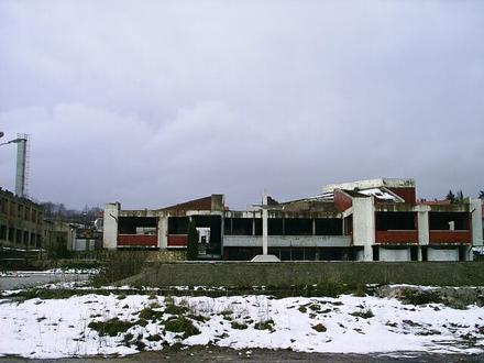
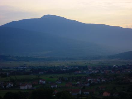
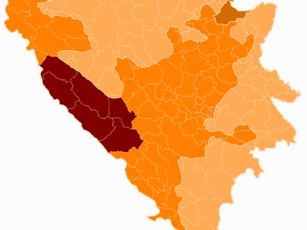
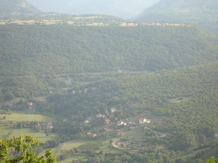
Drvar, Federation of Bosnia and Herzegovina
Drvar (Serbian Cyrillic: Дрвар, pronounced [dř̩ʋaːr]) is a town and municipality in western Bosnia and Herzegovina, located on the road between Bosansko Grahovo and Bosanski Petrovac, also near Glamoč. It is administratively part of Canton 10 of the .. Drvar Wikipedia Page