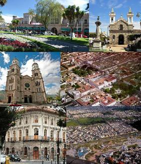
Businesses in El Ángel
Hotels & Travel
Industries
Business Distribution by Industry Hotels & Travel: 60%
Industry: 20%
Automotive: 20%
| Area of El Ángel, Carchi Province | 105.4 km² |
| Population | 6,649 |
| Male Population | 3,202 (48.2%) |
| Female Population | 3,447 (51.8%) |
| Population change from 1975 to 2015 | +46.9% |
| Population change from 2000 to 2015 | +6.9% |
| Median Age | 26.8 |
| Male Median Age | 25.6 |
| Female Median Age | 28 |
| Area Codes | 6 |
| Local Time | Saturday 11:03 AM |
| Timezone | Ecuador Time |
| Lat & Lng | 0.62279° / -77.94003° |
| Postal Codes | 040353 |
El Ángel, Carchi Province - Map
El Ángel, Carchi Province Population
Years 1975 to 2015| Data | 1975 | 1990 | 2000 | 2015 |
|---|---|---|---|---|
| Population | 4,527 | 5,634 | 6,217 | 6,649 |
| Population Density | 42.9 / km² | 53.4 / km² | 59.0 / km² | 63.1 / km² |
El Ángel Population change from 2000 to 2015
Increase of 6.9% from year 2000 to 2015| Location | Change since 1975 | Change since 1990 | Change since 2000 |
|---|---|---|---|
| El Ángel, Carchi Province | +46.9% | +18% | +6.9% |
| Carchi | +49% | +19.5% | +7.9% |
| Ecuador | +131.1% | +58.1% | +27.9% |
El Ángel, Carchi Province Median Age
Median Age: 26.8 years| Location | Median Age | Median Age (Female) | Median Age (Male) |
|---|---|---|---|
| El Ángel, Carchi Province | 26.8 years | 28 years | 25.6 years |
| Carchi | 26.1 years | 26.9 years | 25.2 years |
| Ecuador | 25.1 years | 25.6 years | 24.5 years |
El Ángel, Carchi Province Population Tree
Population By Age and Gender| Age | Male | Female | Total |
|---|---|---|---|
| Under 5 | 296 | 297 | 593 |
| 5-9 | 319 | 340 | 659 |
| 10-14 | 370 | 365 | 735 |
| 15-19 | 338 | 299 | 637 |
| 20-24 | 252 | 266 | 518 |
| 25-29 | 228 | 259 | 488 |
| 30-34 | 222 | 232 | 454 |
| 35-39 | 204 | 214 | 419 |
| 40-44 | 172 | 202 | 375 |
| 45-49 | 144 | 192 | 336 |
| 50-54 | 127 | 158 | 285 |
| 55-59 | 123 | 139 | 262 |
| 60-64 | 96 | 111 | 207 |
| 65-69 | 90 | 107 | 197 |
| 70-74 | 79 | 89 | 169 |
| 75-79 | 79 | 96 | 176 |
| 80-84 | 36 | 45 | 82 |
| 85 Plus | 28 | 37 | 66 |
El Ángel, Carchi Province Population Density
Population Density: 63.1 / km²| Location | Population | Area | Population Density |
|---|---|---|---|
| El Ángel, Carchi Province | 6,649 | 105.4 km² | 63.1 / km² |
| Carchi | 173,870 | 3,827.1 km² | 45.4 / km² |
| Ecuador | 15.8 million | 256,053.3 km² | 61.9 / km² |
El Ángel, Carchi Province Historical and Projected Population
Estimated Ancient Population until 2100Sources:
1. JRC (European Commission's Joint Research Centre) work on the GHS built-up grid
2. CIESIN (Center for International Earth Science Information Network)
3. [Link] Klein Goldewijk, K., Beusen, A., Doelman, J., and Stehfest, E.: Anthropogenic land use estimates for the Holocene – HYDE 3.2, Earth Syst. Sci. Data, 9, 927–953, https://doi.org/10.5194/essd-9-927-2017, 2017.
Human Development Index (HDI)
Statistic composite index of life expectancy, education, and per capita income.Sources: [Link] Kummu, M., Taka, M. & Guillaume, J. Gridded global datasets for Gross Domestic Product and Human Development Index over 1990–2015. Sci Data 5, 180004 (2018) doi:10.1038/sdata.2018.4
El Ángel, Carchi Province CO2 Emissions
Carbon Dioxide (CO2) Emissions Per Capita in Tonnes Per Year| Location | CO2 Emissions | CO2 Emissions Per Capita | CO2 Emissions Intensity |
|---|---|---|---|
| El Ángel, Carchi Province | 17,197 tn | 2.59 tn | 163.1 tons/km² |
| Carchi | 446,660 tn | 2.57 tn | 116.7 tons/km² |
| Ecuador | 43,886,499 tn | 2.77 tn | 171.4 tons/km² |
El Ángel, Carchi Province CO2 Emissions
| 2013 CO2 emissions (tonnes/year) | 17,197 tn |
| 2013 CO2 emissions (tonnes/year) per capita | 2.59 tn |
| 2013 CO2 emissions intensity (tonnes/km²/year) | 163.1 tons/km² |
Natural Hazards Risk
Relative risk out of 10| Landslide | High (9) |
| Flood | High (9) |
| Volcano | Medium (4) |
| Earthquake | High (7.3) |
* Risk, particularly concerning flood or landslide, may not be for the entire area.
Sources: 1. Dilley, M., R.S. Chen, U. Deichmann, A.L. Lerner-Lam, M. Arnold, J. Agwe, P. Buys, O. Kjekstad, B. Lyon, and G. Yetman. 2005. Natural Disaster Hotspots: A Global Risk Analysis. Washington, D.C.: World Bank. https://doi.org/10.1596/0-8213-5930-4.
2. Center for Hazards and Risk Research - CHRR - Columbia University, Center for International Earth Science Information Network - CIESIN - Columbia University. 2005. Global Flood Hazard Frequency and Distribution. Palisades, NY: NASA Socioeconomic Data and Applications Center (SEDAC). https://doi.org/10.7927/H4668B3D.
3. Center for Hazards and Risk Research - CHRR - Columbia University, Center for International Earth Science Information Network - CIESIN - Columbia University. 2005. Global Volcano Hazard Frequency and Distribution. Palisades, NY: NASA Socioeconomic Data and Applications Center (SEDAC). https://doi.org/10.7927/H4BR8Q45.
4. Center for Hazards and Risk Research - CHRR - Columbia University, Center for International Earth Science Information Network - CIESIN - Columbia University. 2005. Global Earthquake Hazard Distribution - Peak Ground Acceleration. Palisades, NY: NASA Socioeconomic Data and Applications Center (SEDAC). https://doi.org/10.7927/H4BZ63ZS.
5. Center for Hazards and Risk Research - CHRR - Columbia University, Center for International Earth Science Information Network - CIESIN - Columbia University, and Norwegian Geotechnical Institute - NGI. 2005. Global Landslide Hazard Distribution. Palisades, NY: NASA Socioeconomic Data and Applications Center (SEDAC). https://doi.org/10.7927/H4P848VZ.
Recent Nearby Earthquakes
Magnitude 3.0 and greater| Date | Time | Magnitude | Distance | Depth | Location | Link |
|---|---|---|---|---|---|---|
| 5/13/19 | 11:00 AM | 4.6 | 9.5 km | 1,360 m | 10km WNW of El Angel, Ecuador | usgs.gov |
| 2/13/19 | 10:24 PM | 4.8 | 17.3 km | 10,000 m | 5km NE of San Gabriel, Ecuador | usgs.gov |
| 5/22/18 | 6:36 AM | 5 | 56 km | 33,370 m | 28km NW of Cotacachi, Ecuador | usgs.gov |
| 1/25/18 | 7:02 AM | 4.5 | 49.2 km | 10,000 m | 30km SE of Pimampiro, Ecuador | usgs.gov |
| 2/27/15 | 11:00 AM | 4 | 69.1 km | 113,460 m | 0km N of Imues, Colombia | usgs.gov |
| 1/24/15 | 12:39 PM | 4.6 | 19.7 km | 4,000 m | 20km N of El Angel, Ecuador | usgs.gov |
| 12/27/14 | 11:11 AM | 4.4 | 25.6 km | 10,000 m | 26km NW of El Angel, Ecuador | usgs.gov |
| 11/10/14 | 5:53 PM | 4.4 | 15.8 km | 32,430 m | 12km N of San Gabriel, Ecuador | usgs.gov |
| 10/29/14 | 7:52 AM | 4.7 | 28.4 km | 10,000 m | 7km SW of Cumbal, Colombia | usgs.gov |
| 10/21/14 | 10:23 AM | 4.5 | 6.9 km | 9,880 m | 7km NNW of El Angel, Ecuador | usgs.gov |
Find historical earthquake occurrences near El Ángel, Carchi Province
Earliest Date Latest Date
Magnitude 3.0 and greater Magnitude 4.0 and greater Magnitude 5.0 and greater


About Our Data
The data on this page is estimated using a number of publicly available tools and resources. It is provided without warranty, and could contain inaccuracies. Use at your own risk. See here for more information.