Businesses in Downpatrick
Hotels & Travel
Restaurants
Automotive
Financial Services
Medical
Beauty & Spas
Community & Government
Industries
Business Distribution by Industry Shopping: 16.5%
Industry: 13.9%
Professional Services: 9.8%
Home Services: 8.3%
Food: 7.4%
Restaurants: 6.1%
Automotive: 5.4%
Hotels & Travel: 5.3%
Other: 27.2%
| Area of Downpatrick, Northern Ireland | 8 km² |
| Population | 9,773 |
| Male Population | 4,773 (48.8%) |
| Female Population | 5,000 (51.2%) |
| Population change from 1975 to 2015 | -10% |
| Population change from 2000 to 2015 | +1.2% |
| Median Age | 34 |
| Male Median Age | 32.7 |
| Female Median Age | 35.2 |
| Area Codes | 28 |
| Neighborhoods | Ardglass, Clough, Crossgar, Killough, Killyleagh, Strangford |
| Local Time | Sunday 7:04 AM |
| Timezone | British Summer Time |
| Lat & Lng | 54.32814° / -5.71529° |
| Postal Codes | BT30 |
Downpatrick, Northern Ireland - Map
Downpatrick, Northern Ireland Population
Years 1975 to 2015| Data | 1975 | 1990 | 2000 | 2015 |
|---|---|---|---|---|
| Population | 10,862 | 9,930 | 9,659 | 9,773 |
| Population Density | 1,359 / km² | 1,242 / km² | 1,208 / km² | 1,223 / km² |
Downpatrick Population change from 2000 to 2015
Increase of 1.2% from year 2000 to 2015| Location | Change since 1975 | Change since 1990 | Change since 2000 |
|---|---|---|---|
| Downpatrick, Northern Ireland | -10% | -1.6% | +1.2% |
| Newry Mourne and Down | +33.2% | +25.6% | +17.5% |
| United Kingdom | +15.2% | +13.3% | +9.9% |
Downpatrick, Northern Ireland Median Age
Median Age: 34 years| Location | Median Age | Median Age (Female) | Median Age (Male) |
|---|---|---|---|
| Downpatrick, Northern Ireland | 34 years | 35.2 years | 32.7 years |
| Newry Mourne and Down | 36.2 years | 37 years | 35.3 years |
| United Kingdom | 39.6 years | 40.6 years | 38.5 years |
Downpatrick, Northern Ireland Population Tree
Population By Age and Gender| Age | Male | Female | Total |
|---|---|---|---|
| Under 5 | 413 | 358 | 772 |
| 5-9 | 320 | 312 | 633 |
| 10-14 | 347 | 326 | 674 |
| 15-19 | 358 | 361 | 719 |
| 20-24 | 382 | 379 | 762 |
| 25-29 | 380 | 397 | 777 |
| 30-34 | 339 | 355 | 695 |
| 35-39 | 282 | 308 | 590 |
| 40-44 | 308 | 338 | 647 |
| 45-49 | 334 | 312 | 647 |
| 50-54 | 290 | 323 | 613 |
| 55-59 | 255 | 278 | 534 |
| 60-64 | 216 | 235 | 451 |
| 65-69 | 195 | 229 | 425 |
| 70-74 | 151 | 158 | 309 |
| 75-79 | 110 | 146 | 256 |
| 80-84 | 64 | 96 | 161 |
| 85 Plus | 28 | 88 | 117 |
Downpatrick, Northern Ireland Population Density
Population Density: 1,223 / km²| Location | Population | Area | Population Density |
|---|---|---|---|
| Downpatrick, Northern Ireland | 9,773 | 8 km² | 1,223 / km² |
| Newry Mourne and Down | 179,415 | 1,681 km² | 106.7 / km² |
| United Kingdom | 64.5 million | 247,916.6 km² | 260.3 / km² |
Downpatrick, Northern Ireland Historical Population
Estimated Population from 800 to 2015Sources:
1. JRC (European Commission's Joint Research Centre) work on the GHS built-up grid
2. CIESIN (Center for International Earth Science Information Network)
3. [Link] Klein Goldewijk, K., Beusen, A., Doelman, J., and Stehfest, E.: Anthropogenic land use estimates for the Holocene – HYDE 3.2, Earth Syst. Sci. Data, 9, 927–953, https://doi.org/10.5194/essd-9-927-2017, 2017.
Neighborhoods
Business Distribution by neighborhood in Downpatrick Crossgar: 39.3%
Killyleagh: 20.5%
Ardglass: 11.3%
Clough: 6.1%
Strangford: 6.1%
Other: 16.6%
Area Codes
Percentage Area Codes used by businesses in Downpatrick Area Code 28: 83.2%
Area Code 77: 6.9%
Other: 9.8%
Business distribution by price for Downpatrick, Northern Ireland
Inexpensive: 45.1%
Moderate: 37.8%
Very Expensive: 12.2%
Expensive: 4.9%
Human Development Index (HDI)
Statistic composite index of life expectancy, education, and per capita income.Sources: [Link] Kummu, M., Taka, M. & Guillaume, J. Gridded global datasets for Gross Domestic Product and Human Development Index over 1990–2015. Sci Data 5, 180004 (2018) doi:10.1038/sdata.2018.4
Downpatrick, Northern Ireland CO2 Emissions
Carbon Dioxide (CO2) Emissions Per Capita in Tonnes Per Year| Location | CO2 Emissions | CO2 Emissions Per Capita | CO2 Emissions Intensity |
|---|---|---|---|
| Downpatrick, Northern Ireland | 107,503 tn | 11 tn | 13,455 tons/km² |
| Newry Mourne and Down | 1,940,078 tn | 10.8 tn | 1,154 tons/km² |
| United Kingdom | 735,672,543 tn | 11.4 tn | 2,967 tons/km² |
Downpatrick, Northern Ireland CO2 Emissions
| 2013 CO2 emissions (tonnes/year) | 107,503 tn |
| 2013 CO2 emissions (tonnes/year) per capita | 11 tn |
| 2013 CO2 emissions intensity (tonnes/km²/year) | 13,455 tons/km² |

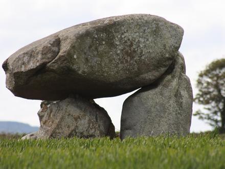
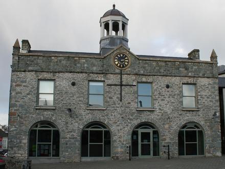
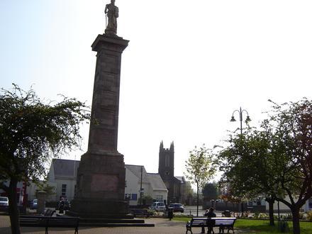
Downpatrick, Northern Ireland
(from Irish: Dún Pádraig, meaning "Patrick's stronghold") is a medium-sized town about 33 km (21 mi) south of Belfast in County Down, Northern Ireland. It has been an important site since ancient times. Its cathedral is said to be the burial place .. Downpatrick Wikipedia Page
About Our Data
The data on this page is estimated using a number of publicly available tools and resources. It is provided without warranty, and could contain inaccuracies. Use at your own risk. See here for more information.