- World
- »
- GB
- »
- Wales
- »
- Llanidloes, Wales
Businesses in Llanidloes
Hotels & Travel
Restaurants
Automotive
Financial Services
Medical
Beauty & Spas
Community & Government
Industries
Business Distribution by Industry Industry: 23.1%
Shopping: 15.3%
Hotels & Travel: 9.5%
Professional Services: 9.3%
Food: 8.7%
Home Services: 6%
Other: 28.1%
| Industry Description | Number of Establishments | Average Age of Business | Average Google Rating | Businesses per 1,000 residents |
|---|---|---|---|---|
| Car repair | 6 | 4.9 | 2.0 | |
| Beauty salons | 5 | 4.6 | 1.7 | |
| Grocery stores and supermarkets | 47 | 18.1 years | 4.3 | 15.7 |
| Street vendors | 5 | 4.5 | 1.7 | |
| General contractors | 17 | 4.5 | 5.7 | |
| Bed and breakfasts | 7 | 4.6 | 2.3 | |
| Campgrounds | 5 | 4.8 | 1.7 | |
| Hotels and motels | 10 | 4.3 | 3.3 | |
| Other accommodation | 22 | 4.5 | 7.3 | |
| Other membership organizations | 5 | 4.5 | 1.7 | |
| Tractors and farm equipment | 33 | 4.6 | 11.0 | |
| Wholesale of machinery | 8 | 2.7 | ||
| Health and medical | 7 | 3.5 | 2.3 | |
| Animal and pet stores | 7 | 4.8 | 2.3 | |
| Churches | 6 | 3.0 | 2.0 | |
| Bars, pubs and taverns | 15 | 4.3 | 5.0 | |
| Clothing stores | 5 | 4.9 | 1.7 | |
| Hardware stores | 6 | 4.3 | 2.0 | |
| Shopping other | 5 | 1.7 |
| Area of Llanidloes, Wales | 5.5 km² |
| Population | 2,997 |
| Male Population | 1,478 (49.3%) |
| Female Population | 1,519 (50.7%) |
| Population change from 1975 to 2015 | +8% |
| Population change from 2000 to 2015 | +6.6% |
| Median Age | 47 |
| Male Median Age | 44 |
| Female Median Age | 50 |
| Area Codes | 1686 |
| Neighborhoods | Dolwen, Llangurig, Tylwch |
| Local Time | Thursday 4:33 AM |
| Timezone | British Summer Time |
| Lat & Lng | 52.44977° / -3.53997° |
| Postal Codes | SY18 |
Llanidloes, Wales - Map
Llanidloes, Wales Population
Years 1975 to 2015| Data | 1975 | 1990 | 2000 | 2015 |
|---|---|---|---|---|
| Population | 2,774 | 2,776 | 2,812 | 2,997 |
| Population Density | 508.5 / km² | 508.8 / km² | 515.4 / km² | 549.3 / km² |
Llanidloes Population change from 2000 to 2015
Increase of 6.6% from year 2000 to 2015| Location | Change since 1975 | Change since 1990 | Change since 2000 |
|---|---|---|---|
| Llanidloes, Wales | +8% | +8% | +6.6% |
| Powys | +7.2% | +7.8% | +6.5% |
| United Kingdom | +15.2% | +13.3% | +9.9% |
Llanidloes, Wales Median Age
Median Age: 47 years| Location | Median Age | Median Age (Female) | Median Age (Male) |
|---|---|---|---|
| Llanidloes, Wales | 47 years | 50 years | 44 years |
| Powys | 46.6 years | 47.6 years | 45.6 years |
| United Kingdom | 39.6 years | 40.6 years | 38.5 years |
Llanidloes, Wales Population Tree
Population By Age and Gender| Age | Male | Female | Total |
|---|---|---|---|
| Under 5 | 91 | 79 | 171 |
| 5-9 | 71 | 42 | 114 |
| 10-14 | 86 | 66 | 152 |
| 15-19 | 85 | 92 | 177 |
| 20-24 | 97 | 85 | 183 |
| 25-29 | 82 | 78 | 161 |
| 30-34 | 80 | 67 | 147 |
| 35-39 | 59 | 66 | 126 |
| 40-44 | 109 | 97 | 207 |
| 45-49 | 111 | 88 | 200 |
| 50-54 | 100 | 99 | 200 |
| 55-59 | 79 | 99 | 179 |
| 60-64 | 94 | 120 | 214 |
| 65-69 | 88 | 98 | 187 |
| 70-74 | 79 | 90 | 169 |
| 75-79 | 68 | 90 | 158 |
| 80-84 | 66 | 78 | 144 |
| 85 Plus | 33 | 85 | 118 |
Llanidloes, Wales Population Density
Population Density: 549.3 / km²| Location | Population | Area | Population Density |
|---|---|---|---|
| Llanidloes, Wales | 2,997 | 5.5 km² | 549.3 / km² |
| Powys | 134,972 | 5,198.1 km² | 26.0 / km² |
| United Kingdom | 64.5 million | 247,916.6 km² | 260.3 / km² |
Neighborhoods
Business Distribution by neighborhood in Llanidloes Llangurig: 23.3%
Dolwen: 20%
Tylwch: 10%
Van: 6.7%
Old Hall: 6.7%
Llanidloes: 6.7%
Town Centre: 6.7%
Cwmbelan: 3.3%
Pant Mawr: 3.3%
Glan-y-nant: 3.3%
Glyn-Brochan: 3.3%
Llandloes, Llanidloes: 3.3%
Dulas Villas, Llanidloes: 3.3%
Business distribution by price for Llanidloes, Wales
Inexpensive: 48.1%
Moderate: 37%
Expensive: 11.1%
Very Expensive: 3.7%
Human Development Index (HDI)
Statistic composite index of life expectancy, education, and per capita income.Sources: [Link] Kummu, M., Taka, M. & Guillaume, J. Gridded global datasets for Gross Domestic Product and Human Development Index over 1990–2015. Sci Data 5, 180004 (2018) doi:10.1038/sdata.2018.4
Llanidloes, Wales CO2 Emissions
Carbon Dioxide (CO2) Emissions Per Capita in Tonnes Per Year| Location | CO2 Emissions | CO2 Emissions Per Capita | CO2 Emissions Intensity |
|---|---|---|---|
| Llanidloes, Wales | 37,497 tn | 12.5 tn | 6,873 tons/km² |
| Powys | 1,669,544 tn | 12.4 tn | 321.2 tons/km² |
| United Kingdom | 735,672,543 tn | 11.4 tn | 2,967 tons/km² |
Llanidloes, Wales CO2 Emissions
| 2013 CO2 emissions (tonnes/year) | 37,497 tn |
| 2013 CO2 emissions (tonnes/year) per capita | 12.5 tn |
| 2013 CO2 emissions intensity (tonnes/km²/year) | 6,873 tons/km² |
Natural Hazards Risk
Relative risk out of 10| Flood | High (10) |
| Earthquake | Low (2) |
* Risk, particularly concerning flood or landslide, may not be for the entire area.
Sources: 1. Dilley, M., R.S. Chen, U. Deichmann, A.L. Lerner-Lam, M. Arnold, J. Agwe, P. Buys, O. Kjekstad, B. Lyon, and G. Yetman. 2005. Natural Disaster Hotspots: A Global Risk Analysis. Washington, D.C.: World Bank. https://doi.org/10.1596/0-8213-5930-4.
2. Center for Hazards and Risk Research - CHRR - Columbia University, Center for International Earth Science Information Network - CIESIN - Columbia University. 2005. Global Flood Hazard Frequency and Distribution. Palisades, NY: NASA Socioeconomic Data and Applications Center (SEDAC). https://doi.org/10.7927/H4668B3D.
3. Center for Hazards and Risk Research - CHRR - Columbia University, Center for International Earth Science Information Network - CIESIN - Columbia University. 2005. Global Earthquake Hazard Distribution - Peak Ground Acceleration. Palisades, NY: NASA Socioeconomic Data and Applications Center (SEDAC). https://doi.org/10.7927/H4BZ63ZS.
Recent Nearby Earthquakes
Magnitude 3.0 and greater| Date | Time | Magnitude | Distance | Depth | Location | Link |
|---|---|---|---|---|---|---|
| 2/17/18 | 6:31 AM | 4.3 | 83.7 km | 11,550 m | 5km NE of Clydach, United Kingdom | usgs.gov |
| 5/28/13 | 8:16 PM | 3.8 | 93.2 km | 10,000 m | 15km WSW of Nefyn, United Kingdom | usgs.gov |
| 10/26/08 | 11:06 AM | 3.9 | 74.9 km | 9,300 m | England, United Kingdom | usgs.gov |
| 11/30/07 | 2:05 PM | 3.3 | 49.6 km | 12,000 m | Wales, United Kingdom | usgs.gov |
| 2/14/05 | 10:44 AM | 3.8 | 93.1 km | 4,900 m | United Kingdom | usgs.gov |
| 9/22/02 | 8:32 PM | 3.2 | 95.7 km | 9,300 m | England, United Kingdom | usgs.gov |
| 9/22/02 | 4:53 PM | 4.8 | 94.7 km | 9,400 m | England, United Kingdom | usgs.gov |
| 2/12/02 | 11:13 AM | 3.5 | 85.7 km | 8,300 m | Wales-England region, United Kingdom | usgs.gov |
| 10/25/99 | 12:15 PM | 4.5 | 68.3 km | 10,000 m | Wales-England region, United Kingdom | usgs.gov |
| 8/31/99 | 10:00 PM | 3.3 | 91.4 km | 10,000 m | Wales, United Kingdom | usgs.gov |
Find historical earthquake occurrences near Llanidloes, Wales
Earliest Date Latest Date
Magnitude 3.0 and greater Magnitude 4.0 and greater Magnitude 5.0 and greater

Llanidloes, Wales
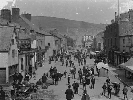
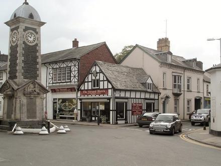
(Welsh pronunciation: [ɬanˈɪdlɔɨs]) is a town along the A470 road and B4518 road in Powys, within the historic county boundaries of Montgomeryshire (Welsh: Sir Drefaldwyn), Wales. The population in 2011 was 2,929, of whom 15% could speak Welsh. is.. Llanidloes Wikipedia Page
About Our Data
The data on this page is estimated using a number of publicly available tools and resources. It is provided without warranty, and could contain inaccuracies. Use at your own risk. See here for more information.