Businesses in Myinmu
| Area Codes | 71 |
| Local Time | Thursday 8:33 AM |
| Timezone | Myanmar Time |
| Lat & Lng | 21.92411° / 95.57659° |
Recent Nearby Earthquakes
Magnitude 3.0 and greater| Date | Time | Magnitude | Distance | Depth | Location | Link |
|---|---|---|---|---|---|---|
| 6/25/18 | 5:02 PM | 4.6 | 64.3 km | 21,810 m | 14km NW of Monywa, Burma | usgs.gov |
| 4/26/18 | 8:18 PM | 4.3 | 77.4 km | 124,720 m | 44km SW of Monywa, Burma | usgs.gov |
| 4/8/18 | 10:40 AM | 4.5 | 91 km | 10,000 m | 38km E of Shwebo, Burma | usgs.gov |
| 3/24/18 | 11:41 AM | 4.2 | 83.8 km | 118,820 m | 51km SW of Monywa, Burma | usgs.gov |
| 11/4/17 | 1:29 PM | 4.3 | 9.1 km | 34,870 m | 41km W of Sagaing, Burma | usgs.gov |
| 8/19/16 | 3:45 AM | 4.2 | 48.5 km | 22,280 m | 23km S of Shwebo, Burma | usgs.gov |
| 8/1/16 | 3:01 AM | 5.1 | 95.3 km | 131,470 m | 17km W of Pakokku, Burma | usgs.gov |
| 11/27/15 | 4:04 AM | 4.6 | 95.3 km | 13,790 m | 54km NNW of Monywa, Burma | usgs.gov |
| 5/21/15 | 5:43 AM | 4.2 | 96.5 km | 22,560 m | 27km NE of Shwebo, Burma | usgs.gov |
| 3/7/15 | 9:45 PM | 4.4 | 77.7 km | 10,000 m | 13km E of Shwebo, Burma | usgs.gov |
Find historical earthquake occurrences near Myinmu, Sagaing Region
Earliest Date Latest Date
Magnitude 3.0 and greater Magnitude 4.0 and greater Magnitude 5.0 and greater
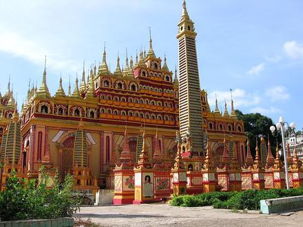
Myinmu, Sagaing Region
Myinmu (Burmese: မြင်းမူ) is a river town in the south-east of the Sagaing Division in Burma. The town has a rich history linked to World War II during the Burma Campaign against the Japanese, in 1944. It was also under the control of the Portuguese .. Myinmu Wikipedia Page