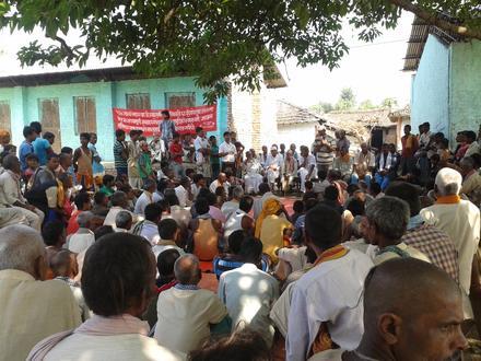
Businesses in Mahottari District
| Population | 627,580 |
| Area Codes | 44 |
| Local Time | Friday 9:19 PM |
| Timezone | Nepal Time |
| Lat & Lng | 26.6876° / 85.81819° |
Recent Nearby Earthquakes
Magnitude 3.0 and greater| Date | Time | Magnitude | Distance | Depth | Location | Link |
|---|---|---|---|---|---|---|
| 7/1/17 | 6:58 PM | 4.8 | 67.8 km | 10,000 m | 10km SSE of Ramechhap, Nepal | usgs.gov |
| 2/26/17 | 8:21 PM | 4.6 | 76.5 km | 20,280 m | 16km WNW of Ramechhap, Nepal | usgs.gov |
| 2/26/17 | 7:37 PM | 4.7 | 85.8 km | 11,230 m | 11km N of Ramechhap, Nepal | usgs.gov |
| 4/3/16 | 9:31 PM | 4.2 | 94.3 km | 23,690 m | 32km E of Panaoti, Nepal | usgs.gov |
| 6/29/15 | 2:46 PM | 4.3 | 87.2 km | 10,000 m | 26km ESE of Panaoti, Nepal | usgs.gov |
| 6/22/15 | 12:34 AM | 4.3 | 96.1 km | 10,000 m | 25km NNW of Ramechhap, Nepal | usgs.gov |
| 5/22/15 | 4:45 AM | 4.3 | 97.6 km | 10,000 m | 24km N of Ramechhap, Nepal | usgs.gov |
| 5/18/15 | 3:49 PM | 4.4 | 99.9 km | 10,000 m | 34km NNW of Ramechhap, Nepal | usgs.gov |
| 5/16/15 | 10:45 PM | 4.3 | 98.6 km | 10,000 m | 30km E of Panaoti, Nepal | usgs.gov |
| 5/16/15 | 4:34 AM | 5.5 | 100 km | 7,000 m | 26km N of Ramechhap, Nepal | usgs.gov |
Find historical earthquake occurrences near Mahottari District, Central Development Region
Earliest Date Latest Date
Magnitude 3.0 and greater Magnitude 4.0 and greater Magnitude 5.0 and greater
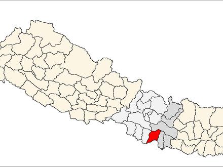
Mahottari District, Central Development Region
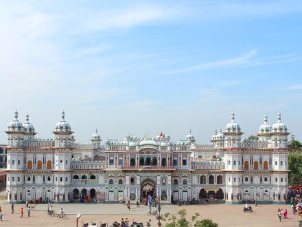
Mahottari District (Nepali: महोत्तरी जिल्ला, Listen ), a part of Janakpur Zone, is one of the seventy-five districts of Nepal. The district, with Jaleswar as its district headquarters, covers an area of 1,002 km² and had a population of 553,481 in 20.. Mahottari District Wikipedia Page