- World
- »
- US
- »
- Nevada
- »
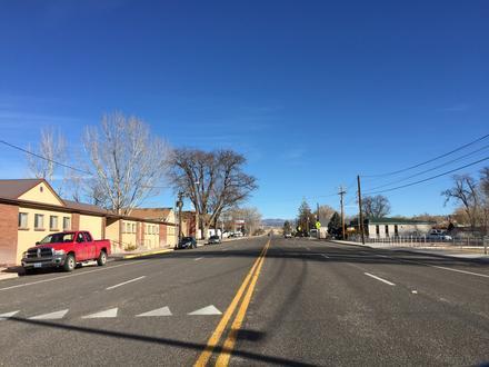
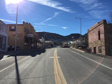
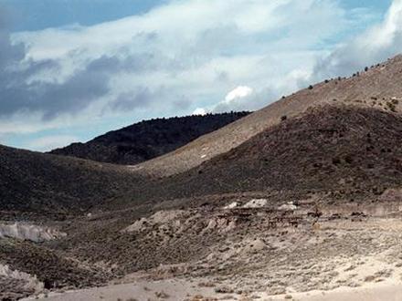
- Caliente, Nevada
Businesses in Caliente, Nevada
Hotels & Travel
Restaurants
Automotive
Financial Services
Medical
Beauty & Spas
Community & Government
Industries
Business Distribution by Industry Medical: 14.5%
Shopping: 14.1%
Community & Government: 10.4%
Hotels & Travel: 8.7%
Restaurants: 7.5%
Professional Services: 6.2%
Home Services: 5.8%
Industry: 5.4%
Automotive: 5.4%
Sports & Activities: 5%
Other: 17%
| Industry Description | Number of Establishments | Average Age of Business | Average Google Rating | Businesses per 1,000 residents |
|---|---|---|---|---|
| Firefighting and rescue | 7 | 27.7 years | 5.0 | 5.2 |
| Public administration | 11 | 54.8 years | 4.2 | 8.2 |
| Health and medical | 11 | 3.6 | 8.2 |
| Area of Caliente, Nevada | 1.853 sq mi |
| Population | 1,342 |
| Male Population | 698 (52%) |
| Female Population | 644 (48%) |
| Population change from 1975 to 2015 | +633.3% |
| Population change from 2000 to 2015 | +40.2% |
| Median Age | 37.9 |
| Male Median Age | 32.8 |
| Female Median Age | 43.4 |
| Area Codes | 775 |
| Local Time | Wednesday 8:33 PM |
| Timezone | Pacific Daylight Time |
| Lat & Lng | 37.61496° / -114.51194° |
Caliente, Nevada - Map
Caliente, Nevada Population
Years 1975 to 2015| Data | 1975 | 1990 | 2000 | 2015 |
|---|---|---|---|---|
| Population | 183 | 451 | 957 | 1,342 |
| Population Density | 98.7 / mi² | 243.3 / mi² | 516.4 / mi² | 724.1 / mi² |
Caliente, Nevada Population change from 2000 to 2015
Increase of 40.2% from year 2000 to 2015| Location | Change since 1975 | Change since 1990 | Change since 2000 |
|---|---|---|---|
| Caliente, Nevada | +633.3% | +197.6% | +40.2% |
| Nevada | +240.2% | +114.5% | +55.2% |
| United States | +46.9% | +27.2% | +13.7% |
Caliente, Nevada Median Age
Median Age: 37.9 years| Location | Median Age | Median Age (Female) | Median Age (Male) |
|---|---|---|---|
| Caliente, Nevada | 37.9 years | 43.4 years | 32.8 years |
| Nevada | 36.3 years | 36.9 years | 35.8 years |
| United States | 37.4 years | 38.7 years | 36.1 years |
Caliente, Nevada Population Tree
Population By Age and Gender| Age | Male | Female | Total |
|---|---|---|---|
| Under 5 | 43 | 34 | 77 |
| 5-9 | 51 | 35 | 87 |
| 10-14 | 57 | 41 | 99 |
| 15-19 | 110 | 72 | 183 |
| 20-24 | 40 | 31 | 71 |
| 25-29 | 27 | 34 | 62 |
| 30-34 | 37 | 22 | 59 |
| 35-39 | 28 | 29 | 57 |
| 40-44 | 38 | 36 | 75 |
| 45-49 | 29 | 45 | 75 |
| 50-54 | 27 | 46 | 74 |
| 55-59 | 54 | 46 | 101 |
| 60-64 | 37 | 42 | 79 |
| 65-69 | 49 | 52 | 101 |
| 70-74 | 30 | 30 | 61 |
| 75-79 | 14 | 12 | 27 |
| 80-84 | 17 | 18 | 35 |
| 85 Plus | 10 | 18 | 29 |
Caliente, Nevada Population Density
Population Density: 724.1 / mi²| Location | Population | Area | Population Density |
|---|---|---|---|
| Caliente, Nevada | 1,342 | 1.853 sq mi | 724.1 / mi² |
| Nevada | 3.1 million | 110,572.6 sq mi | 28.2 / mi² |
| United States | 321.6 million | 3,796,761.2 sq mi | 84.7 / mi² |
Caliente, Nevada Historical and Projected Population
Estimated Population from 1910 to 2100Sources:
1. JRC (European Commission's Joint Research Centre) work on the GHS built-up grid
2. CIESIN (Center for International Earth Science Information Network)
3. [Link] Klein Goldewijk, K., Beusen, A., Doelman, J., and Stehfest, E.: Anthropogenic land use estimates for the Holocene – HYDE 3.2, Earth Syst. Sci. Data, 9, 927–953, https://doi.org/10.5194/essd-9-927-2017, 2017.
Business distribution by price for Caliente, Nevada
Inexpensive: 52.4%
Moderate: 38.1%
Expensive: 9.5%
Human Development Index (HDI)
Statistic composite index of life expectancy, education, and per capita income.Sources: [Link] Kummu, M., Taka, M. & Guillaume, J. Gridded global datasets for Gross Domestic Product and Human Development Index over 1990–2015. Sci Data 5, 180004 (2018) doi:10.1038/sdata.2018.4
Caliente, Nevada CO2 Emissions
Carbon Dioxide (CO2) Emissions Per Capita in Tonnes Per Year| Location | CO2 Emissions | CO2 Emissions Per Capita | CO2 Emissions Intensity |
|---|---|---|---|
| Caliente, Nevada | 20,702 tn | 15.4 tn | 11,170 tons/mi² |
| Nevada | 55,621,449 tn | 17.8 tn | 503 tons/mi² |
| United States | 5,664,619,809 tn | 17.6 tn | 1,491 tons/mi² |
Caliente, Nevada CO2 Emissions
| 2013 CO2 emissions (tonnes/year) | 20,702 tn |
| 2013 CO2 emissions (tonnes/year) per capita | 15.4 tn |
| 2013 CO2 emissions intensity (tonnes/mi²/year) |
Natural Hazards Risk
Relative risk out of 10| Earthquake | Medium (4) |
* Risk, particularly concerning flood or landslide, may not be for the entire area.
Sources: 1. Dilley, M., R.S. Chen, U. Deichmann, A.L. Lerner-Lam, M. Arnold, J. Agwe, P. Buys, O. Kjekstad, B. Lyon, and G. Yetman. 2005. Natural Disaster Hotspots: A Global Risk Analysis. Washington, D.C.: World Bank. https://doi.org/10.1596/0-8213-5930-4.
2. Center for Hazards and Risk Research - CHRR - Columbia University, Center for International Earth Science Information Network - CIESIN - Columbia University. 2005. Global Earthquake Hazard Distribution - Peak Ground Acceleration. Palisades, NY: NASA Socioeconomic Data and Applications Center (SEDAC). https://doi.org/10.7927/H4BZ63ZS.
Recent Nearby Earthquakes
Magnitude 3.0 and greater| Date | Time | Magnitude | Distance | Depth | Location | Link |
|---|---|---|---|---|---|---|
| 6/30/19 | 4:43 PM | 4.2 | 25.9 km | 3,100 m | 19km SE of Pioche, Nevada | usgs.gov |
| 6/17/17 | 5:17 AM | 3.3 | 25.2 km | 7,000 m | 25km SE of Caliente, Nevada | usgs.gov |
| 6/13/17 | 11:13 PM | 3.2 | 31.7 km | 7,000 m | 31km SE of Caliente, Nevada | usgs.gov |
| 6/12/15 | 7:05 AM | 3.4 | 40.4 km | 5,200 m | 40km SSW of Caliente, Nevada | usgs.gov |
| 5/26/15 | 7:31 PM | 3.1 | 35.3 km | 7,100 m | 35km SSW of Caliente, Nevada | usgs.gov |
| 5/26/15 | 7:04 PM | 3.2 | 29.2 km | 8,500 m | 29km SSW of Caliente, Nevada | usgs.gov |
| 5/26/15 | 5:03 PM | 3.3 | 32.3 km | 8,900 m | 32km SSW of Caliente, Nevada | usgs.gov |
| 5/22/15 | 10:14 PM | 3.41 | 34.3 km | 11,070 m | 34km ESE of Caliente, Nevada | usgs.gov |
| 5/22/15 | 12:41 PM | 3.5 | 36.1 km | 5,900 m | 36km SSW of Caliente, Nevada | usgs.gov |
| 5/22/15 | 12:05 PM | 3.8 | 35.3 km | 9,600 m | 35km SSW of Caliente, Nevada | usgs.gov |
Find historical earthquake occurrences near Caliente, Nevada
Earliest Date Latest Date
Magnitude 3.0 and greater Magnitude 4.0 and greater Magnitude 5.0 and greater

Caliente, Nevada
Caliente /kæliˈɛnti/, formerly known as Culverwell and Calientes, is a city in Lincoln County, Nevada, United States. Its elevation is 4,300 feet (1,310 meters). The population was 1,130 at the 2010 census. The city's name originated from the nearby .. Caliente, Nevada Wikipedia Page
About Our Data
The data on this page is estimated using a number of publicly available tools and resources. It is provided without warranty, and could contain inaccuracies. Use at your own risk. See here for more information.