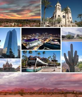
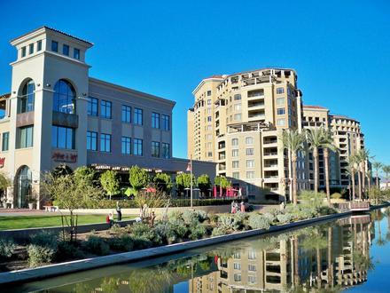
Businesses in Paradise Valley
Hotels & Travel
Restaurants
Automotive
Financial Services
Medical
Beauty & Spas
Community & Government
Industries
Business Distribution by Industry Medical: 21.1%
Professional Services: 17.8%
Shopping: 12.1%
Home Services: 11.4%
Financial Services: 7.4%
Industry: 6.4%
Other: 23.8%
| Industry Description | Number of Establishments | Average Age of Business | Average Google Rating | Businesses per 1,000 residents |
|---|---|---|---|---|
| Beauty salons | 26 | 23 years | 4.7 | 1.8 |
| Day spas | 11 | 28.3 years | 4.8 | 0.8 |
| Hairdressers | 20 | 25.1 years | 4.7 | 1.4 |
| Banks | 12 | 35.9 years | 4.0 | 0.8 |
| Finance other | 22 | 29.5 years | 5.0 | 1.5 |
| Loan companies | 36 | 24.6 years | 4.8 | 2.5 |
| Construction of houses | 11 | 30.5 years | 4.8 | 0.8 |
| General contractors | 44 | 25.4 years | 4.1 | 3.0 |
| Interior decorations | 14 | 30.5 years | 1.0 | |
| Real estate | 101 | 28.2 years | 4.6 | 7.0 |
| Construction of buildings | 27 | 28.9 years | 4.7 | 1.9 |
| Other membership organizations | 11 | 28.5 years | 3.0 | 0.8 |
| Dentists | 30 | 31.1 years | 4.9 | 2.1 |
| Health and medical | 218 | 26.7 years | 4.5 | 15.1 |
| Hospitals | 13 | 30.3 years | 3.8 | 0.9 |
| Physicians and surgeons | 85 | 29.6 years | 4.3 | 5.9 |
| Business services | 11 | 25.5 years | 0.8 | |
| Corporate management | 45 | 29.2 years | 4.9 | 3.1 |
| Lawyers legal | 22 | 30.7 years | 4.5 | 1.5 |
| Scientific and technical services | 39 | 26.9 years | 5.0 | 2.7 |
| Specialized design | 17 | 28.4 years | 3.7 | 1.2 |
| Technical construction services | 13 | 46 years | 4.7 | 0.9 |
| Churches | 13 | 47.1 years | 4.7 | 0.9 |
| Clothing stores | 17 | 27.9 years | 4.5 | 1.2 |
| Household appliances and goods | 14 | 34.1 years | 1.0 | |
| Women's clothing | 11 | 25.1 years | 4.6 | 0.8 |
| Area of Paradise Valley, Arizona | 15.42 sq mi |
| Population | 14,432 |
| Male Population | 7,097 (49.2%) |
| Female Population | 7,335 (50.8%) |
| Population change from 1975 to 2015 | +135.2% |
| Population change from 2000 to 2015 | +36.4% |
| Median Age | 51.6 |
| Male Median Age | 51.8 |
| Female Median Age | 51.4 |
| Area Codes | 480, 602 |
| Neighborhoods | Central Scottsdale, Paradise Valley Plaza, Paradise Valley Village, Resort Corridor, South Scottsdale |
| Local Time | Thursday 4:04 PM |
| Timezone | Mountain Standard Time |
| Lat & Lng | 33.53115° / -111.94265° |
| Zip Codes | 85253 |
Paradise Valley, Arizona - Map
Paradise Valley, Arizona Population
Years 1975 to 2015| Data | 1975 | 1990 | 2000 | 2015 |
|---|---|---|---|---|
| Population | 6,137 | 8,527 | 10,582 | 14,432 |
| Population Density | 397.9 / mi² | 552.8 / mi² | 686.1 / mi² | 935.7 / mi² |
Paradise Valley Population change from 2000 to 2015
Increase of 36.4% from year 2000 to 2015| Location | Change since 1975 | Change since 1990 | Change since 2000 |
|---|---|---|---|
| Paradise Valley, Arizona | +135.2% | +69.3% | +36.4% |
| Arizona | +146.4% | +75.2% | +37.8% |
| United States | +46.9% | +27.2% | +13.7% |
Paradise Valley, Arizona Median Age
Median Age: 51.6 years| Location | Median Age | Median Age (Female) | Median Age (Male) |
|---|---|---|---|
| Paradise Valley, Arizona | 51.6 years | 51.4 years | 51.8 years |
| Arizona | 36 years | 37.1 years | 34.8 years |
| United States | 37.4 years | 38.7 years | 36.1 years |
Paradise Valley, Arizona Population Tree
Population By Age and Gender| Age | Male | Female | Total |
|---|---|---|---|
| Under 5 | 237 | 235 | 472 |
| 5-9 | 393 | 413 | 806 |
| 10-14 | 519 | 479 | 998 |
| 15-19 | 516 | 489 | 1,006 |
| 20-24 | 217 | 210 | 427 |
| 25-29 | 146 | 143 | 290 |
| 30-34 | 134 | 151 | 285 |
| 35-39 | 214 | 299 | 514 |
| 40-44 | 368 | 434 | 802 |
| 45-49 | 553 | 612 | 1,165 |
| 50-54 | 692 | 711 | 1,404 |
| 55-59 | 645 | 690 | 1,336 |
| 60-64 | 726 | 731 | 1,457 |
| 65-69 | 617 | 546 | 1,163 |
| 70-74 | 406 | 434 | 840 |
| 75-79 | 340 | 321 | 661 |
| 80-84 | 228 | 226 | 455 |
| 85 Plus | 147 | 213 | 360 |
Paradise Valley, Arizona Population Density
Population Density: 935.7 / mi²| Location | Population | Area | Population Density |
|---|---|---|---|
| Paradise Valley, Arizona | 14,432 | 15.42 sq mi | 935.7 / mi² |
| Arizona | 7.1 million | 113,991 sq mi | 62.4 / mi² |
| United States | 321.6 million | 3,796,761.2 sq mi | 84.7 / mi² |
Paradise Valley, Arizona Historical and Projected Population
Estimated Population from 1910 to 2100Sources:
1. JRC (European Commission's Joint Research Centre) work on the GHS built-up grid
2. CIESIN (Center for International Earth Science Information Network)
3. [Link] Klein Goldewijk, K., Beusen, A., Doelman, J., and Stehfest, E.: Anthropogenic land use estimates for the Holocene – HYDE 3.2, Earth Syst. Sci. Data, 9, 927–953, https://doi.org/10.5194/essd-9-927-2017, 2017.
Neighborhoods
Business Distribution by neighborhood in Paradise Valley Paradise Valley Village: 41.5%
South Scottsdale: 5.6%
Other: 52.8%
Area Codes
Percentage Area Codes used by businesses in Paradise Valley Area Code 480: 78.7%
Area Code 602: 19.3%
Other: 2%
Business distribution by price for Paradise Valley, Arizona
Moderate: 43.1%
Expensive: 33.3%
Inexpensive: 11.8%
Very Expensive: 11.8%
Human Development Index (HDI)
Statistic composite index of life expectancy, education, and per capita income.Sources: [Link] Kummu, M., Taka, M. & Guillaume, J. Gridded global datasets for Gross Domestic Product and Human Development Index over 1990–2015. Sci Data 5, 180004 (2018) doi:10.1038/sdata.2018.4
Paradise Valley, Arizona CO2 Emissions
Carbon Dioxide (CO2) Emissions Per Capita in Tonnes Per Year| Location | CO2 Emissions | CO2 Emissions Per Capita | CO2 Emissions Intensity |
|---|---|---|---|
| Paradise Valley, Arizona | 369,001 tn | 25.6 tn | 23,923 tons/mi² |
| Arizona | 120,455,171 tn | 16.9 tn | 1,056 tons/mi² |
| United States | 5,664,619,809 tn | 17.6 tn | 1,491 tons/mi² |
Paradise Valley, Arizona CO2 Emissions
| 2013 CO2 emissions (tonnes/year) | 369,001 tn |
| 2013 CO2 emissions (tonnes/year) per capita | 25.6 tn |
| 2013 CO2 emissions intensity (tonnes/mi²/year) |
Natural Hazards Risk
Relative risk out of 10| Drought | High (9) |
| Earthquake | Low (2) |
* Risk, particularly concerning flood or landslide, may not be for the entire area.
Sources: 1. Dilley, M., R.S. Chen, U. Deichmann, A.L. Lerner-Lam, M. Arnold, J. Agwe, P. Buys, O. Kjekstad, B. Lyon, and G. Yetman. 2005. Natural Disaster Hotspots: A Global Risk Analysis. Washington, D.C.: World Bank. https://doi.org/10.1596/0-8213-5930-4.
2. Center for Hazards and Risk Research - CHRR - Columbia University, Center for International Earth Science Information Network - CIESIN - Columbia University, and International Research Institute for Climate and Society - IRI - Columbia University. 2005. Global Drought Hazard Frequency and Distribution. Palisades, NY: NASA Socioeconomic Data and Applications Center (SEDAC). https://doi.org/10.7927/H4VX0DFT.
3. Center for Hazards and Risk Research - CHRR - Columbia University, Center for International Earth Science Information Network - CIESIN - Columbia University. 2005. Global Earthquake Hazard Distribution - Peak Ground Acceleration. Palisades, NY: NASA Socioeconomic Data and Applications Center (SEDAC). https://doi.org/10.7927/H4BZ63ZS.
Recent Nearby Earthquakes
Magnitude 3.0 and greater| Date | Time | Magnitude | Distance | Depth | Location | Link |
|---|---|---|---|---|---|---|
| 12/9/16 | 6:51 PM | 3.2 | 43.9 km | 3,260 m | 11km ENE of Rio Verde, Arizona | usgs.gov |
| 11/1/15 | 10:49 PM | 3.6 | 66.6 km | 6,670 m | 4km NNE of Black Canyon City, Arizona | usgs.gov |
| 11/1/15 | 10:29 PM | 4 | 69.3 km | 5,920 m | 7km NNE of Black Canyon City, Arizona | usgs.gov |
| 11/1/15 | 7:59 PM | 3.2 | 71.3 km | 5,000 m | 8km N of Black Canyon City, Arizona | usgs.gov |
| 9/20/14 | 1:02 PM | 3.2 | 87.6 km | 6,040 m | 30km NNW of Miami, Arizona | usgs.gov |
| 6/25/10 | 3:30 AM | 3.1 | 69.9 km | 5,000 m | Arizona | usgs.gov |
| 5/8/09 | 11:07 PM | 3.1 | 77.8 km | 5,000 m | Arizona | usgs.gov |
About Our Data
The data on this page is estimated using a number of publicly available tools and resources. It is provided without warranty, and could contain inaccuracies. Use at your own risk. See here for more information.